
IMAGES TAKEN NEAR TO
Leslie Street, GLASGOW, G41 2RS
Introduction
This page details the photographs taken nearby to Leslie Street, G41 2RS by members of the Geograph project.
The Geograph project started in 2005 with the aim of publishing, organising and preserving representative images for every square kilometre of Great Britain, Ireland and the Isle of Man.

There are currently over 7.5m images from over14,400 individuals and you can help contribute to the project by visiting https://www.geograph.org.uk
Image Map
Images are licensed for reuse under creativecommons.org/licenses/by-sa/2.0
Notes
- Clicking on the map will re-center to the selected point.
- The higher the marker number, the further away the image location is from the centre of the postcode.
Image Listing (108 Images Found)
Images are licensed for reuse under creativecommons.org/licenses/by-sa/2.0
Image
Details
Distance
1
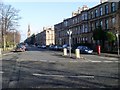
Shields Road
Road in Pollokshields. Looking north from Nithsdale Road.
Image: © Stephen Sweeney
Taken: 25 Feb 2009
0.03 miles
2
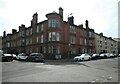
Junction of Keir Street and Leslie Street
Red sandstone tenement with interesting corner rooms.
Image: © Richard Sutcliffe
Taken: 14 May 2022
0.06 miles
3

Shields Road, Glasgow
Showing position of Postbox No. G41 513.
Image: © JThomas
Taken: 14 Sep 2021
0.06 miles
4
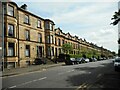
Shields Road
A long terrace between Albert Drive and Leslie Street, dating from 1874-76. The entire terrace is Category B listed http://portal.historicenvironment.scot/designation/LB33479.
Image: © Richard Sutcliffe
Taken: 14 May 2022
0.06 miles
5
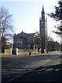
Nithsdale Lodge Care Home
Former church and now care home in Pollokshields.
Image: © Stephen Sweeney
Taken: 25 Feb 2009
0.06 miles
6
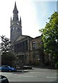
Rowandale Nursing Home
Originally built as Pollokshields Free Church in 1875-9, it became Pollokshields West UF Church in 1900. It later became a Church of Scotland and later still was occupied by the Nithsdale Church Trust of the Plymouth Brethren. It is now the Rowandale Nursing Home.
Image: © Richard Sutcliffe
Taken: 14 May 2022
0.07 miles
7
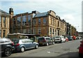
Pollokshields Primary School
Seen from Herriet Street. The part of the school on the left dates from 1882. The part seen here is a later extension from 1901. The whole school is Category B listed http://portal.historicenvironment.scot/designation/LB33370.
Image: © Richard Sutcliffe
Taken: 14 May 2022
0.08 miles
8
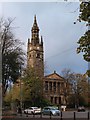
Rowandale Nursing Home
This former church, now a private care home, is seen looking across Nithsdale Road.
Image: © Alec MacKinnon
Taken: 22 Oct 2017
0.08 miles
9
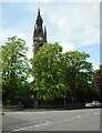
Tower, Rowandale Nursing Home
Originally built as Pollokshields Free Church in 1875-9, it became Pollokshields West UF Church in 1900. It later became a Church of Scotland and later still was occupied by the Nithsdale Church Trust of the Plymouth Brethren. It is now the Rowandale Nursing Home.
Image: © Richard Sutcliffe
Taken: 14 May 2022
0.08 miles
10
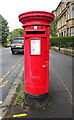
Pillar Box on Shields Road, Glasgow
Postbox No. G41 513.
Image: © JThomas
Taken: 14 Sep 2021
0.08 miles