IMAGES TAKEN NEAR TO
London Road, GLASGOW, G40 1AG

Introduction

This page details the photographs taken nearby to London Road, G40 1AG by members of the Geograph project.

The Geograph project started in 2005 with the aim of publishing, organising and preserving representative images for every square kilometre of Great Britain, Ireland and the Isle of Man.

There are currently over 7.5m images from over14,400 individuals and you can help contribute to the project by visiting https://www.geograph.org.uk

Image Map


Images are licensed for reuse under creativecommons.org/licenses/by-sa/2.0
Notes
  • Clicking on the map will re-center to the selected point.
  • The higher the marker number, the further away the image location is from the centre of the postcode.

Image Listing (358 Images Found)

Images are licensed for reuse under creativecommons.org/licenses/by-sa/2.0
  • ...
Image
Details
Distance
1
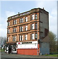
Craignestock Mansions
The London Road side of the building. See also Image & Image
Image: © Thomas Nugent Taken: 12 Apr 2008
0.00 miles
2
Craignestock mansions
See the building here Image & Image
Image: © Thomas Nugent Taken: 12 Apr 2008
0.01 miles
3
Craignestock mansions
A corner tenement at London Road (on the right) and Green Street (on the left). See also Image & Image
Image: © Thomas Nugent Taken: 12 Apr 2008
0.01 miles
4
Craignestock Mansions
At the corner of London Road and Green Street, which is to the left.
Image: © Thomas Nugent Taken: 26 Jan 2013
0.01 miles
5
Glasgow Green station
The station closed in 1951 and today only the facade remains although the Argyle Line on which it stands is still open. Glasgow Green lies between Argyle Street and Bridgeton stations. See the tracks here Image 2019 update: The building has been demolished, but the lettering has been saved Image
Image: © Thomas Nugent Taken: 12 Apr 2008
0.04 miles
6
Glasgow Green station
This trackside view of the disused station shows little evidence that a station ever existed here. See the exterior here Image
Image: © Thomas Nugent Taken: 12 Apr 2008
0.04 miles
7
Glasgow Green Station
This station finally closed in 1953. The two platforms are gone and all that remains of the building is the southern and western walls, the windows and doors of which have been bricked up. You can see this view from a small back lane which runs to the rear of the station. I don't really know the significance, if any, of the dates(?) on the wall. Although the station never reopened, the actual line was re-established in the mid 1960's for trains from Maryhill to Rutherglen and beyond.
Image: © Carol Walker Taken: 25 Jan 2010
0.05 miles
8
Thenue Housing association
Thenue is a housing association, based on London Road http://www.thenuehousing.co.uk/ .
Image: © Thomas Nugent Taken: 19 Nov 2016
0.06 miles
9
Glasgow Green Station
This station is sited at Binnie Place.It was originally owned by the Caledonian Railway Company and was opened on November 1st 1885. It was closed as a wartime economy measure in 1917 but reopened. It was finally closed in 1953. The station was demolished as part of GEAR (Glasgow eastern Area redevelopment), but the facade was left in place as a Grade A listed building.
Image: © Carol Walker Taken: 25 Jan 2010
0.06 miles
10
Calton Heritage & Learning Centre
On London Road at Tobago Street.
Image: © Thomas Nugent Taken: 17 May 2014
0.06 miles
  • ...