
IMAGES TAKEN NEAR TO
Sutcliffe Road, GLASGOW, G13 1BY
Introduction
This page details the photographs taken nearby to Sutcliffe Road, G13 1BY by members of the Geograph project.
The Geograph project started in 2005 with the aim of publishing, organising and preserving representative images for every square kilometre of Great Britain, Ireland and the Isle of Man.

There are currently over 7.5m images from over14,400 individuals and you can help contribute to the project by visiting https://www.geograph.org.uk
Image Map
Images are licensed for reuse under creativecommons.org/licenses/by-sa/2.0
Notes
- Clicking on the map will re-center to the selected point.
- The higher the marker number, the further away the image location is from the centre of the postcode.
Image Listing (73 Images Found)
Images are licensed for reuse under creativecommons.org/licenses/by-sa/2.0
Image
Details
Distance
1

Anniesland from the air
Featuring the Category A Listed https://portal.historicenvironment.scot/apex/f?p=1505:300:::::VIEWTYPE,VIEWREF:designation,LB43034 22 storey residential tower at Anniesland Cross which was built in 1966-68. Kelvin Court (above the towerblock) is Category B Listed https://portal.historicenvironment.scot/apex/f?p=1505:300:::::VIEWTYPE,VIEWREF:designation,LB32321 as is the arched railway bridge over Great Western Road https://portal.historicenvironment.scot/apex/f?p=1505:300:::::VIEWTYPE,VIEWREF:designation,LB43373. Seen from above Drumchapel shortly after taking off from Glasgow Airport.
Image: © Thomas Nugent
Taken: 20 Jul 2025
0.05 miles
2
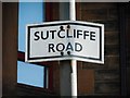
Sutcliffe Road sign
Sign for Sutcliffe Road [http://www.geograph.org.uk/photo/5755448].
Image: © Richard Sutcliffe
Taken: 27 Apr 2018
0.06 miles
5
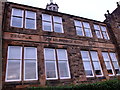
Temple School
The old sandstone buildings of Glasgow and around bred optimism like no other material. The school board in the parish of New Kilpatrick, Dunbartonshire, were sure that they would outlive this sturdy nineteenth-century building. It was not to be; when Glasgow embarked on clearing its festering slums in the 1930s it annexed part of New Kilpatrick for new housing. The school is now a private nursery.
Image: © Rosalind Mitchell
Taken: 15 Nov 2017
0.10 miles
6
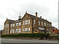
Former Temple School, Fulton Street, Anniesland
A primary school built in 1899 for the New Kilpatrick School Board, architect Henry Higgins (1848-1922), and listed category C (LB43039). It closed in 2007 and is now occupied by a day nursery.
Image: © Stephen Craven
Taken: 25 Jun 2019
0.10 miles
7
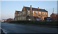
Former Temple Primary School
A Category C listed school on the corner of Fulton Street and Spencer Street, built in 1899. It is now in use as the Little Me Nursery Temple. They provide childcare and pre-school education for children aged from six weeks to five years.
Image: © Richard Sutcliffe
Taken: 23 Jan 2017
0.11 miles
8
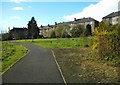
Anniesland Meadow
A small park surrounded by housing just beside Anniesland Cross.
Image: © Richard Sutcliffe
Taken: 27 Apr 2018
0.11 miles
9
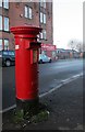
Pillarbox, Fulton Street
Postbox number G13 389 on Fulton Street.
Image: © Richard Sutcliffe
Taken: 23 Jan 2017
0.12 miles
10
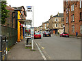
Bus stop on Fulton Street, Anniesland
For buses to Partick.
Image: © Stephen Craven
Taken: 25 Jun 2019
0.12 miles