Temple School
Introduction
The photograph on this page of Temple School by Rosalind Mitchell as part of the Geograph project.
The Geograph project started in 2005 with the aim of publishing, organising and preserving representative images for every square kilometre of Great Britain, Ireland and the Isle of Man.

There are currently over 7.5m images from over 14,400 individuals and you can help contribute to the project by visiting https://www.geograph.org.uk
Temple School
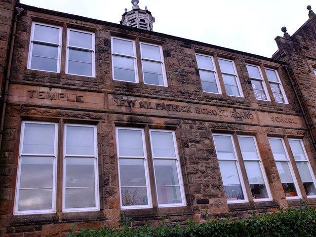
Image: © Rosalind Mitchell Taken: 15 Nov 2017
The old sandstone buildings of Glasgow and around bred optimism like no other material. The school board in the parish of New Kilpatrick, Dunbartonshire, were sure that they would outlive this sturdy nineteenth-century building. It was not to be; when Glasgow embarked on clearing its festering slums in the 1930s it annexed part of New Kilpatrick for new housing. The school is now a private nursery.
Images are licensed for reuse under creativecommons.org/licenses/by-sa/2.0
Image Location
Latitude
55.894642
Longitude
-4.325792