
IMAGES TAKEN NEAR TO
Elizabeth Court, POULTON-LE-FYLDE, FY6 7BJ
Introduction
This page details the photographs taken nearby to Elizabeth Court, FY6 7BJ by members of the Geograph project.
The Geograph project started in 2005 with the aim of publishing, organising and preserving representative images for every square kilometre of Great Britain, Ireland and the Isle of Man.

There are currently over 7.5m images from over14,400 individuals and you can help contribute to the project by visiting https://www.geograph.org.uk
Image Map
Images are licensed for reuse under creativecommons.org/licenses/by-sa/2.0
Notes
- Clicking on the map will re-center to the selected point.
- The higher the marker number, the further away the image location is from the centre of the postcode.
Image Listing (169 Images Found)
Images are licensed for reuse under creativecommons.org/licenses/by-sa/2.0
Image
Details
Distance
1
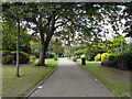
Jean Stansfield Memorial Park, Poulton-Le-Fylde
Image: © David Dixon
Taken: 1 Sep 2011
0.05 miles
2
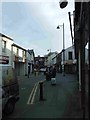
Breck Road, Poulton le Fylde
Looking South down Breck Rd. The Thatched House pub can be seen at the end.
Image: © Colin Eastwood
Taken: 12 Mar 2007
0.07 miles
3
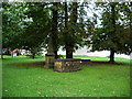
St Chad's Church, Poulton-le-Fylde, Graveyard
Image: © Alexander P Kapp
Taken: 9 Sep 2008
0.09 miles
4
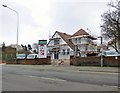
Vicarage Park Community Centre
The Arts and Crafts style building opened in 1925 as St Chad's Church Hall. Before it closed in 2013 it was used for a wide variety of community activities. A charity was formed with the aim of raising the £300,000 needed to pay for its restoration, At the time this photograph was taken £125k had been raised.
Update: The new centre opened on September 1st 2018.
Image: © Gerald England
Taken: 12 Apr 2018
0.10 miles
5
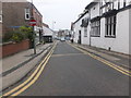
Chapel Street, Poulton-le-Fylde
The part-timbered building on the right is the Thatched House Hotel.
Image: © Barbara Carr
Taken: 30 Oct 2013
0.10 miles
6
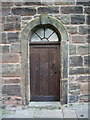
St Chad's Church, Poulton-le-Fylde, Doorway
Image: © Alexander P Kapp
Taken: 9 Sep 2008
0.10 miles
7
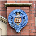
Constabulary Station
Coat of arms on Poulton-le-Fyle Police Station Image
Image: © Gerald England
Taken: 27 Aug 2016
0.10 miles
8
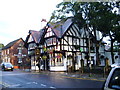
The Thatched House, Poulton-le-Fylde
Image: © Alexander P Kapp
Taken: 9 Sep 2008
0.10 miles
9
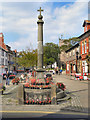
Stocks and Market Cross, Poulton-Le-Fylde
The market cross probably dates from the 17th century. It is similar to those at Kirkland and Garstang (Image]).
The stocks, probably from the 18th century, consist of two short, stone pillars with a pair of wooden stock beams. The beams, which have been replaced several times, contain two pairs of leg-holes.
Both are Grade II listed structures.
Image: © David Dixon
Taken: 1 Sep 2011
0.10 miles
10
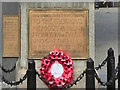
War Memorial Inscription
The inscription on Image
Image: © David Dixon
Taken: 1 Sep 2011
0.10 miles