
IMAGES TAKEN NEAR TO
Blairlogie, STIRLING, FK9 5QB
Introduction
This page details the photographs taken nearby to FK9 5QB by members of the Geograph project.
The Geograph project started in 2005 with the aim of publishing, organising and preserving representative images for every square kilometre of Great Britain, Ireland and the Isle of Man.

There are currently over 7.5m images from over14,400 individuals and you can help contribute to the project by visiting https://www.geograph.org.uk
Image Map
Images are licensed for reuse under creativecommons.org/licenses/by-sa/2.0
Notes
- Clicking on the map will re-center to the selected point.
- The higher the marker number, the further away the image location is from the centre of the postcode.
Image Listing (7 Images Found)
Images are licensed for reuse under creativecommons.org/licenses/by-sa/2.0
Image
Details
Distance

2

Farmland at East Gogar
Recently ploughed farmland at East Gogar, with the town of Menstrie and the Ochil Hills in the background.
Image: © William Starkey
Taken: 9 Mar 2012
0.14 miles
3
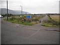
Turn for Blackgrange
The old alignment of the A907 at the turn for the Blackgrange bonded warehouses. Route 76 of the National Cycle Network runs through the warehouse complex.
Image: © Richard Webb
Taken: 18 Sep 2009
0.14 miles
4
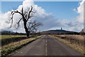
West along the old Alloa Road
Looking in the opposite direction to Image this shows the view towards the west along the old Alloa Road which is now a cycle path. The Wallace Monument is on the skyline towards the right of the image.
Image: © Doug Lee
Taken: 3 Mar 2014
0.19 miles
5
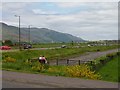
New and old roads.
The A907 Stirling to Kincardine road has been rebuilt here, the old road now a cycle track. As well as the flatness within NS8395 there is a good view of the Hillfoots Scarp (Ochil Hills)
Image: © Richard Webb
Taken: 4 Jun 2006
0.19 miles
6
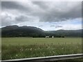
Grassland east of Stirling
At centre is West Gogar
Image: © Eirian Evans
Taken: 27 Jun 2022
0.22 miles
7
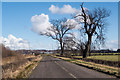
The old Alloa Road
The old road is now a cycle path and is blocked off to avoid usage by cars
Image: © Doug Lee
Taken: 3 Mar 2014
0.24 miles