IMAGES TAKEN NEAR TO
STIRLING, FK9 5NU
Introduction
This page details the photographs taken nearby to FK9 5NU by members of the Geograph project.
The Geograph project started in 2005 with the aim of publishing, organising and preserving representative images for every square kilometre of Great Britain, Ireland and the Isle of Man.

There are currently over 7.5m images from over14,400 individuals and you can help contribute to the project by visiting https://www.geograph.org.uk
Image Map
Images are licensed for reuse under creativecommons.org/licenses/by-sa/2.0
Notes
- Clicking on the map will re-center to the selected point.
- The higher the marker number, the further away the image location is from the centre of the postcode.
Image Listing (15 Images Found)
Images are licensed for reuse under creativecommons.org/licenses/by-sa/2.0
Image
Details
Distance
1

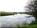
Wester Cornton, fields
View across the carse towards the Stirling - Perth railway and the Wester Ochils.
Image: © Robert Murray
Taken: 30 Jul 2011
0.07 miles
2
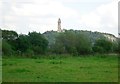
Wester Cornton, fields
The Wallace National Monument dominating the scene across the carse.
Image: © Robert Murray
Taken: 30 Jul 2011
0.07 miles
3
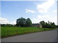
Wester Cornton Farm
The B823 in the foreground.
Image: © Robert Murray
Taken: 30 Jul 2011
0.08 miles
4
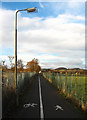
Cycle route
Probably not the most aesthetically pleasing section of cycle route in the area, but widely used by local cyclists.
Image: © William Starkey
Taken: 24 Nov 2010
0.10 miles
5
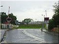
Bridge of Allan, Cornton Road level crossing
A busy one. Up and down like a yo-yo.
Image: © Robert Murray
Taken: 6 Aug 2011
0.12 miles
6
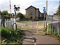
Cycle path at Cornton Road
The cycle/foot path from Causewayhead towards Bridge of Allan meets Cornton Road at its north end here, just next a level crossing.
Image: © Alec MacKinnon
Taken: 20 May 2012
0.12 miles
8
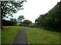
Cornton, path to river Forth
Signage belongs to the Forth Anglers Club.
Image: © Robert Murray
Taken: 2 Jul 2011
0.19 miles
9
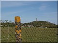
Fenced in
The footpath from Causewayhead to Bridge of Allan runs along the side of the railway line. People using it enjoy views over the surrounding farmland and in this case towards the Wallace monument. A high fence ensures they do not stray onto the fields.
Image: © Alec MacKinnon
Taken: 20 May 2012
0.19 miles