
IMAGES TAKEN NEAR TO
Craigforth, STIRLING, FK9 4UH
Introduction
This page details the photographs taken nearby to FK9 4UH by members of the Geograph project.
The Geograph project started in 2005 with the aim of publishing, organising and preserving representative images for every square kilometre of Great Britain, Ireland and the Isle of Man.

There are currently over 7.5m images from over14,400 individuals and you can help contribute to the project by visiting https://www.geograph.org.uk
Image Map
Images are licensed for reuse under creativecommons.org/licenses/by-sa/2.0
Notes
- Clicking on the map will re-center to the selected point.
- The higher the marker number, the further away the image location is from the centre of the postcode.
Image Listing (18 Images Found)
Images are licensed for reuse under creativecommons.org/licenses/by-sa/2.0
Image
Details
Distance
1
![River Forth near Old Mills Farm [3]](https://s2.geograph.org.uk/geophotos/02/63/59/2635914_6586f335_120x120.jpg)
River Forth near Old Mills Farm [3]
View downstream towards farm on opposite bank.
Image: © Robert Murray
Taken: 6 Oct 2011
0.04 miles
2
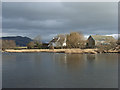
Old Mills Farm and the River Forth
With Dumyat beyond.
Image: © Andrew Smith
Taken: 30 Jan 2007
0.05 miles
3
![River Forth near Old Mills Farm [7]](https://s1.geograph.org.uk/geophotos/02/63/59/2635941_1f96475d_120x120.jpg)
River Forth near Old Mills Farm [7]
According to the first survey of 1861 (pub. 1865) Sheet X.15 (St. Ninians) http://maps.nls.uk/os/25inch/view/?sid=74984133 this may have been the gates of a salmon ladder. The same map places the old mill dam about 100m upstream remains of which can be seen at low water.
See also Image and Image
Image: © Robert Murray
Taken: 6 Oct 2011
0.05 miles
4
![River Forth near Old Mills Farm [5]](https://s1.geograph.org.uk/geophotos/02/63/59/2635929_38b9dc04_120x120.jpg)
River Forth near Old Mills Farm [5]
Remains of the weir gate which are far more noticeable when the river is in spate as it was here.
According to the first survey of 1861 (pub. 1865) Sheet X.15 (St. Ninians) http://maps.nls.uk/os/25inch/view/?sid=74984133 this may have been the gates of a salmon ladder. The same map places the old mill dam about 100m upstream remains of which can be seen at low water.
Image: © Robert Murray
Taken: 6 Oct 2011
0.05 miles
5
![River Forth near Old Mills Farm [4]](https://s3.geograph.org.uk/geophotos/02/63/59/2635923_a4b09603_120x120.jpg)
River Forth near Old Mills Farm [4]
View downstream towards the remains of the weir (at island) which is also the tidal limit.
According to the first survey of 1861 (pub. 1865) Sheet X.15 (St. Ninians) http://maps.nls.uk/os/25inch/view/?sid=74984133 this may have been the gates of a salmon ladder. The same map places the old mill dam about 100m upstream remains of which can be seen at low water.
Image: © Robert Murray
Taken: 6 Oct 2011
0.05 miles
6
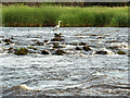
Heron, River Forth
At the tidal limit, with the tide in.
Image: © Andrew Smith
Taken: 19 Jun 2006
0.07 miles
7
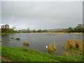
River Forth near Old Mills Farm
Heavily in spate as it usually was in this drenching year of 2011.
Image: © Robert Murray
Taken: 6 Oct 2011
0.07 miles
8
![River Forth near Old Mills Farm [2]](https://s0.geograph.org.uk/geophotos/02/63/59/2635912_3469ee99_120x120.jpg)
River Forth near Old Mills Farm [2]
View upstream just above the tidal limit.
Image: © Robert Murray
Taken: 6 Oct 2011
0.08 miles
10
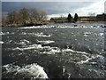
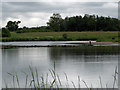
The River Forth
At the tidal limit, just below the broken weirs.
Image: © Andrew Smith
Taken: 30 Jan 2007
0.12 miles