
IMAGES TAKEN NEAR TO
Wellgate Drive, STIRLING, FK9 4RU
Introduction
This page details the photographs taken nearby to Wellgate Drive, FK9 4RU by members of the Geograph project.
The Geograph project started in 2005 with the aim of publishing, organising and preserving representative images for every square kilometre of Great Britain, Ireland and the Isle of Man.

There are currently over 7.5m images from over14,400 individuals and you can help contribute to the project by visiting https://www.geograph.org.uk
Image Map
Images are licensed for reuse under creativecommons.org/licenses/by-sa/2.0
Notes
- Clicking on the map will re-center to the selected point.
- The higher the marker number, the further away the image location is from the centre of the postcode.
Image Listing (10 Images Found)
Images are licensed for reuse under creativecommons.org/licenses/by-sa/2.0
Image
Details
Distance
1
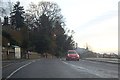
Coneyhill Road/Henderson Street junction bus stop
On the A9 approaching Stirling; Wallace Monument visible ahead.
Image: © Stanley Howe
Taken: 12 Dec 2012
0.16 miles
2
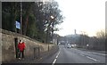
A pedestrian barrier, by the A9 approaching Stirling
Protecting those who might emerge from the Beaconhurst School via the gate in the wall.
Image: © Stanley Howe
Taken: 12 Dec 2012
0.20 miles
5
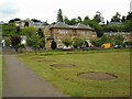
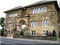
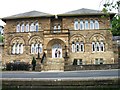
Museum Hall, Henderson Street
The Category B listed http://portal.historicenvironment.scot/designation/LB22639 building, dating from 1886-7 has had a variety of uses. It has been used as the Macfarlane Museum, a public hall, a music venue and has now been converted into flats. It may have been used as the local drill hall in the First World War.
Seen from the Pullar Memorial Park.
Image: © Richard Sutcliffe
Taken: 2 Jun 2022
0.20 miles
6
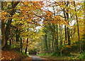
Minor road near Bridge of Allan
A minor road passing Hermitage Wood near Bridge of Allan. Viewed in early November, leaves on beech trees have turned yellow and gold - a spectacular sight.
Image: © William Starkey
Taken: 1 Nov 2010
0.21 miles
7
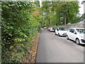
Sheriffmuir Road in Bridge of Allan
Looking eastward.
Image: © Peter Wood
Taken: 4 Oct 2017
0.22 miles
8
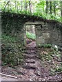
Gate into Hermitage Wood
On the brae above Stirling University.
Image: © Robert Murray
Taken: 14 Sep 2009
0.24 miles
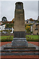
10
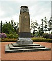
War memorial
In Pullar Memorial Park.
TO THE MEMORY OF THE MEN
OF BRIDGE OF ALLAN WHO DIED
IN THE GREAT WAR 1914-1919
RAISED IN HUMBLE GRATITUDE
The memorial was unveiled in 1923 in what was then a field, but which has subsequently been landscaped as a park, named after the donor of the ground, Mr Edmund Pullar of Westerton.
Image: © Richard Sutcliffe
Taken: 2 Jun 2022
0.25 miles