Museum Hall, Henderson Street
Introduction
The photograph on this page of Museum Hall, Henderson Street by Richard Sutcliffe as part of the Geograph project.
The Geograph project started in 2005 with the aim of publishing, organising and preserving representative images for every square kilometre of Great Britain, Ireland and the Isle of Man.

There are currently over 7.5m images from over 14,400 individuals and you can help contribute to the project by visiting https://www.geograph.org.uk
Museum Hall, Henderson Street
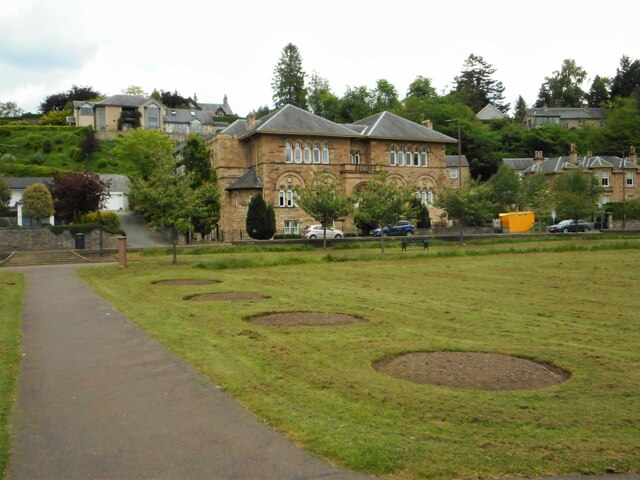
Image: © Richard Sutcliffe Taken: 2 Jun 2022
The Category B listed http://portal.historicenvironment.scot/designation/LB22639 building, dating from 1886-7 has had a variety of uses. It has been used as the Macfarlane Museum, a public hall, a music venue and has now been converted into flats. It may have been used as the local drill hall in the First World War. Seen from the Pullar Memorial Park.
Images are licensed for reuse under creativecommons.org/licenses/by-sa/2.0
Image Location
Latitude
56.152027
Longitude
-3.935903