IMAGES TAKEN NEAR TO
John Murray Drive, STIRLING, FK9 4QH
Introduction
This page details the photographs taken nearby to John Murray Drive, FK9 4QH by members of the Geograph project.
The Geograph project started in 2005 with the aim of publishing, organising and preserving representative images for every square kilometre of Great Britain, Ireland and the Isle of Man.

There are currently over 7.5m images from over14,400 individuals and you can help contribute to the project by visiting https://www.geograph.org.uk
Image Map
Images are licensed for reuse under creativecommons.org/licenses/by-sa/2.0
Notes
- Clicking on the map will re-center to the selected point.
- The higher the marker number, the further away the image location is from the centre of the postcode.
Image Listing (70 Images Found)
Images are licensed for reuse under creativecommons.org/licenses/by-sa/2.0
Image
Details
Distance
1
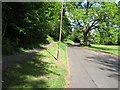
Sunnylaw Road
Road at the top of Bridge of Allan, it divides Mine Woods from an area of big late 19th century houses.
Image: © Richard Webb
Taken: 14 May 2011
0.09 miles
4
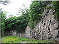
Wolf's Hole Quarry, Bridge of Allan
Basalt lava overlying Devonian sandstone. Source of rock used for building in Bridge of Allan in the 19th century - quarry now popular with climbers.
Image: © William Starkey
Taken: 14 Jun 2010
0.11 miles
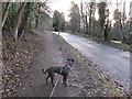
6
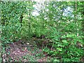
Mine Woods
Steep woodland above Bridge of Allan.
Image: © Richard Webb
Taken: 14 May 2011
0.12 miles
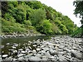
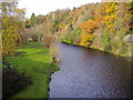
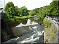
7
![Bridge of Allan, Allan Water [3]](https://s3.geograph.org.uk/geophotos/02/51/35/2513595_5afb2293_120x120.jpg)
Bridge of Allan, Allan Water [3]
A substantial river.
Image: © Robert Murray
Taken: 19 Jul 2011
0.12 miles
8
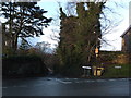
Junction of Ferniebank Brae, Glen Road and Sunnylaw Road, Bridge of Allan
Image: © Alpin Stewart
Taken: 1 Jan 2014
0.12 miles
9
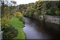
Allan Water
One of the tributaries of the Forth, the Allan is 22 miles long and rises in the Ochil Hills.
Image: © Euan Nelson
Taken: 7 Nov 2010
0.12 miles
10
Weir on the Allan Water
The weir goes right under the road bridge on the left, which carries the A9, Henderson Street over the river. The weir originally held back water to feed a lade taking water to Keirfield, a bleaching and dyeing mill just to the south. The sluice on the right is in poor condition.
Image: © Richard Sutcliffe
Taken: 2 Jun 2022
0.14 miles