
IMAGES TAKEN NEAR TO
Inversnaid, STIRLING, FK8 3TU
Introduction
This page details the photographs taken nearby to FK8 3TU by members of the Geograph project.
The Geograph project started in 2005 with the aim of publishing, organising and preserving representative images for every square kilometre of Great Britain, Ireland and the Isle of Man.

There are currently over 7.5m images from over14,400 individuals and you can help contribute to the project by visiting https://www.geograph.org.uk
Image Map
Images are licensed for reuse under creativecommons.org/licenses/by-sa/2.0
Notes
- Clicking on the map will re-center to the selected point.
- The higher the marker number, the further away the image location is from the centre of the postcode.
Image Listing (10 Images Found)
Images are licensed for reuse under creativecommons.org/licenses/by-sa/2.0
Image
Details
Distance
1
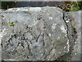
Ordnance Survey Cut Mark with Rivet
This mark and rived can be found on top of the parapet of the road bridge spanning Snaid Burn at Inversnaid.
The recorded details give a height of 115.889 metres above seal level.
For more detail see : https://www.bench-marks.org.uk/bm179874
Image: © Peter Wood
Taken: 8 Sep 2022
0.03 miles
2
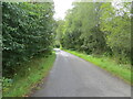
Glen Arklet - Minor road descending towards Inversnaid and Loch Lomond
Looking south-westward.
Image: © Peter Wood
Taken: 8 Sep 2022
0.06 miles
3
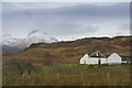
Garrison Farm Inversnaid
This is an RSPB reserve with a good range of wild life if you are very lucky.
Image: © Malcolm Neal
Taken: 1 Jan 2016
0.08 miles
5
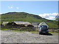
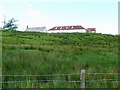
Inversnaid Garrison
The remains of Inversnaid Garrison, built in 1718-19. Some of the garrison has been incorporated into the farm buildings.
The garrison was one of many built by the Government in the aftermath of the 1715 Jacobite uprising, and this particular one may also have been an attempt to subdue Rob Roy McGregor, who was active in the area at this time.
By the 1820s the buildings were in disrepair and being used as an inn, and they fell into disuse soon afterwards.
Image: © Elizabeth Angus
Taken: 18 Jun 2012
0.10 miles
6
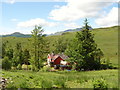
Tin house at Inversnaid
Corrugated tin roofs were common in Scotland, and many older chalet-type houses still have them.
Image: © Elizabeth Angus
Taken: 18 Jun 2012
0.11 miles
7

Inversnaid information board
RSPB reserve information board at Garrison carpark.
Image: © Elizabeth Angus
Taken: 18 Jun 2012
0.12 miles
8
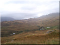
Looking down on Upper Inversnaid from the south.
The cluster of buildings on the right includes Garrison Farm and the former Manse. The building on the left is the Old Parish Church, currently a bunkhouse. The entire square is within this photograph.
Image: © bill copland
Taken: 13 Oct 2006
0.15 miles
9
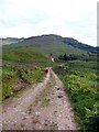
The Inversnaid Garrison track
Highland cattle standing guard.
Image: © Gordon Brown
Taken: 7 Jun 2009
0.23 miles
10
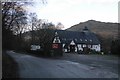
Former church, Inversnaid
The building is now used as a bunkhouse, connected to the Inversnaid Hotel.
Image: © Richard Webb
Taken: 24 Nov 2018
0.23 miles