
IMAGES TAKEN NEAR TO
STIRLING, FK8 3AW
Introduction
This page details the photographs taken nearby to FK8 3AW by members of the Geograph project.
The Geograph project started in 2005 with the aim of publishing, organising and preserving representative images for every square kilometre of Great Britain, Ireland and the Isle of Man.

There are currently over 7.5m images from over14,400 individuals and you can help contribute to the project by visiting https://www.geograph.org.uk
Image Map
Images are licensed for reuse under creativecommons.org/licenses/by-sa/2.0
Notes
- Clicking on the map will re-center to the selected point.
- The higher the marker number, the further away the image location is from the centre of the postcode.
Image Listing (39 Images Found)
Images are licensed for reuse under creativecommons.org/licenses/by-sa/2.0
Image
Details
Distance
1
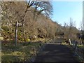
Path to King's Park
The view is from about the same place as Image, but in the opposite direction; note the steep rocky slope to the left.
At the time of writing, OS maps, at various scales, displace the name "The Homesteads" so that it seems to apply to the western end of the plateau above those rocks; the name in fact applies to the area of housing just south of the photographer's position.
Image: © Lairich Rig
Taken: 24 Feb 2018
0.02 miles
2
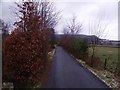
Stirling, the Homesteads
The narrow single file track that leads to the Homesteads (Stirling Model Village 1880s
FOUNDER/LEADER : John Christie.
Proposed model village to have comprised of workers’ cottages with land attached, for rent or sale, arranged around a square with a fountain and public hall.
REF: The Homesteads: Stirlings Garden Suburb.) which is tucked under the crags of the King's Park above.
Image: © Robert Murray
Taken: 13 Mar 2011
0.05 miles
3
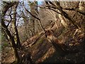
Steep slope above a path
The ground genuinely is sloping to that degree, not the camera. The path is shown in Image, and the slope is to the right (northeast) of it. Nearby parts of the slope were considerably more rocky: Image / Image
Image: © Lairich Rig
Taken: 24 Feb 2018
0.06 miles
4
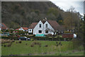
Stirling : Grass & House
A patch of grass and a house.
Image: © Lewis Clarke
Taken: 25 Apr 2016
0.07 miles
5
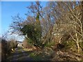
Escarpment beside path
The same section of path is shown in Image, but the emphasis in the present picture is on the escarpment of igneous rock next to it.
Image: © Lairich Rig
Taken: 24 Feb 2018
0.07 miles
6
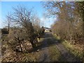
View to footpath junction
The view is towards the location of the signpost shown in Image, and is from the path that heads to the SE from that junction.
There is a steep rocky slope beside the path: Image
Image: © Lairich Rig
Taken: 24 Feb 2018
0.08 miles
7
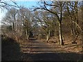
Path by the Homesteads
The Homesteads is the area of housing just to the west (one of the houses can be seen indistinctly ahead), and not, as the map at the time of writing might suggest, the western end of the plateau at the top of the steep rocky slope to the photographer's right; compare Image, to the right of this part of the path, and Image, taken further along the path.
An earlier picture shows a nearby part of the same path in another season: Image
Image: © Lairich Rig
Taken: 24 Feb 2018
0.09 miles
8
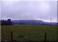
Stirling, towards Gillies Hill
Across the kerse of Bonny towards the historic Gillies Hill http://news.bbc.co.uk/1/hi/scotland/tayside_and_central/6568819.stm the road in mid picture is the M9 motorway.
Image: © Robert Murray
Taken: 13 Mar 2011
0.09 miles
9
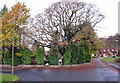
St Thomas Well, wide view
The well has a rich history in legend, but is probably simply a farm pond fed by a spring (hence,'well'). The site is now ingloriously surrounded by modern roads and housing. Closer view: Image
Image: © Richard Dorrell
Taken: 14 Nov 2015
0.09 miles
10
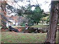
St Thomas Well
Legend and truth intermingle in the history of this site. Legend suggests this was the site of the chapel where Robert the Bruce took the sacrament before Bannockburn and was the holy well known as 'Christ's Well'. However, in truth, there is no evidence of an ancient building on this site, and the well here may be no more than a large farm pond. The pond is now surrounded by trees, a farm steading and a small modern housing development. Wider view: Image
Image: © Richard Dorrell
Taken: 14 Nov 2015
0.09 miles