
IMAGES TAKEN NEAR TO
Victoria Place, STIRLING, FK8 2QU
Introduction
This page details the photographs taken nearby to Victoria Place, FK8 2QU by members of the Geograph project.
The Geograph project started in 2005 with the aim of publishing, organising and preserving representative images for every square kilometre of Great Britain, Ireland and the Isle of Man.

There are currently over 7.5m images from over14,400 individuals and you can help contribute to the project by visiting https://www.geograph.org.uk
Image Map
Images are licensed for reuse under creativecommons.org/licenses/by-sa/2.0
Notes
- Clicking on the map will re-center to the selected point.
- The higher the marker number, the further away the image location is from the centre of the postcode.
Image Listing (95 Images Found)
Images are licensed for reuse under creativecommons.org/licenses/by-sa/2.0
Image
Details
Distance
1
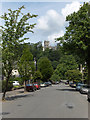
Victoria Place, Stirling
Looking down to Victoria Road with Holy Rude church above.
Image: © Andrew Smith
Taken: 27 Jun 2006
0.02 miles
2
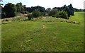
King's Park: remains of the race track
The high ground receding from view is the line of a former race course, shown on the first-edition OS map (surveyed 1858—60). See Image for a view in the opposite direction from the same point.
See Image for a more detailed discussion, with additional comments on a former dam nearby.
Image: © Lairich Rig
Taken: 21 Sep 2019
0.06 miles
3
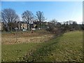
King's Park: remains of the race track
The feature of interest here is the raised area on the right. Looking at online archaeological databases, I saw an entry for it as "Dam (period unassigned)". I was (wrongly, as it turns out) sceptical about that interpretation, but that did at least lead me to investigate, and so to learn that it had once been the course of a race track. For views along the former race track itself, see Image and Image For more on the dam itself, see the concluding paragraphs below.
This raised area was part of an old race track, for horse racing, that used to run along the northern and eastern sides of the park, and through the centre of the park; for its still earlier course, see the concluding comments of this description.
Although the creation of a golf course and other features in the park has made the race track less visible, much of its former route can still be traced easily enough on satellite imagery, and some parts, such as that shown here, are still very evident on the ground.
For example, its western extremity was at Image, where a turning can be seen. The southeastern extremity was at Image, but that portion of the race track is much less visible. From there, it ran back through the centre of the park, passing through Image, to form a loop.
The race track is shown on OS maps from the first edition (surveyed 1858—60) onwards, but it significantly pre-dates OS maps: for example, it is shown on an 1832 plan of Stirling prepared in connection with the Great Reform Act, and on an 1820 plan by John Wood.
The area lies within the King's Park. The OS Name Books (c.1860) observe that the race track is a mile and a quarter in length, and that the part of King's Park that lies within the race track was then under tillage.
Nimmo's 1777 History of Stirlingshire mentions King's Park, then enclosed by a wall, and former gardens within it: "within the gardens is a mound of earth, in the form of a table, called the Knot". This is Image; it is easy to forget that it was once part of King's Park, separated as it now is from the main body of the park by Dumbarton Road. The 1777 work does not mention the race track, which presumably did not then exist, but the two-volume 1880 revision of the same work does mention it, as well as the present-day road: "It is not yet a century since [the King's Park] was first traversed by a public road, the old Dumbarton road having hitherto gone by Cambusbarron."
Part of the course of the old boundary wall around the park can still be discerned on satellite imagery, crossing fields: it leaves the Castle at Image and heads southwest to meet the main road at about Image; it continues SSW to Image, heads SSE for about 60 metres, and then turns to head ESE.
- - • - -
As mentioned at the start of this discussion, I was originally sceptical about this feature's having once been a dam. However, six months after writing the original version of this description, I happened to read the paper "Lidar and the Historic Land-use Assessment of the King's Park, Stirling", by Stephen Digney (Historic Environment Scotland, 2016). A download link for that paper can be found at https://www.stirling-lhs.org/blog/kings-park-stirling-new-understandings (at Stirling Local History).
See pages 15—18, and the discussion of "the Park Loch". A solid case is made there, with support from LIDAR mapping and digital elevation data, that the raised linear feature shown in the present photograph was originally a dam (on which a part of the race track was later built). With regard to the now long gone Park Loch, the author of the paper notes that "a body of water this size and shape could only exist if the embankment is indeed a dam", and that the dam is "a major engineering work of the medieval period". See the paper itself for a detailed discussion; in addition, pages 12—13 discuss the race track, and reveal its earlier course.
Image: © Lairich Rig
Taken: 24 Feb 2018
0.06 miles
4
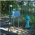
Old drinking fountain
This one, beside one of the entrances of King's Park, is C-listed. It has a ram's head carved at the top. The plaque beside it provides information about all four fountains. Reckoning from north to south, this is the second of them.
Image: © Lairich Rig
Taken: 21 Sep 2019
0.06 miles
5
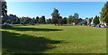
Victoria Square, Stirling
It is shown from the other end in Image
Image: © Lairich Rig
Taken: 21 Sep 2019
0.06 miles
6
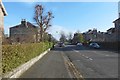
Balmoral Place, Stirling
The view is from Queen's Road. The street consists of nineteenth-century villas.
Image: © Lairich Rig
Taken: 24 Feb 2018
0.06 miles
7
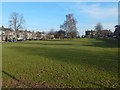
Victoria Square, Stirling
It is shown from the other end in Image The square had not been laid out when the first-edition OS map was surveyed (1858—60), but the second edition (1896) shows it. The group of trees near the centre of the picture is precisely at the centre of the Square.
Albert Place is nearby, and is shown on the first edition of the map; it therefore pre-dates both Victoria Square and the nearby Image
Image: © Lairich Rig
Taken: 24 Feb 2018
0.07 miles
8
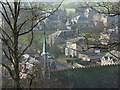
Stirling
The steeple of Holy Trinity Episcopal Church (http://www.geograph.org.uk/photo/250362 ) and houses in Clarendon Place and Victoria Square viewed from the town wall.
Image: © Andrew Smith
Taken: 4 Feb 2007
0.07 miles
9
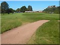
King's Park: remains of the race track
Ignoring the modern sandy track snaking from the lower-left corner, it is possible to discern a long straight raised feature, receding from the lower-right corner of the picture, and passing just left of the club house. This is a visible remnant of the former race track that is mentioned in the end-note. The paper cited there has much more on its route.
On the occasion of taking this picture, I had a friendly chat with some of the golfers nearby; I am grateful for their forbearance in not making an issue of my stepping up briefly onto the course to take these pictures.
See Image for a view in the opposite direction from the same spot. See Image for a more detailed discussion, with additional comments on a former dam nearby.
It does not appear to be well known that a race track once ran through this part of the park. Stirling Castle is in the background.
Image: © Lairich Rig
Taken: 21 Sep 2019
0.08 miles
10
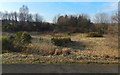
Former gravel pit in King's Park
There is a noticeable hollow here, with a resemblance to a drained body of water, but, as noted at Image, it has a quite different origin: it is labelled "gravel pit" on the first-edition map (1858—60).
Image: © Lairich Rig
Taken: 24 Feb 2018
0.10 miles