King's Park: remains of the race track
Introduction
The photograph on this page of King's Park: remains of the race track by Lairich Rig as part of the Geograph project.
The Geograph project started in 2005 with the aim of publishing, organising and preserving representative images for every square kilometre of Great Britain, Ireland and the Isle of Man.

There are currently over 7.5m images from over 14,400 individuals and you can help contribute to the project by visiting https://www.geograph.org.uk
King's Park: remains of the race track
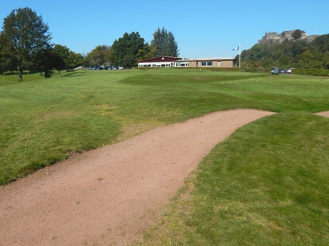
Image: © Lairich Rig Taken: 21 Sep 2019
Ignoring the modern sandy track snaking from the lower-left corner, it is possible to discern a long straight raised feature, receding from the lower-right corner of the picture, and passing just left of the club house. This is a visible remnant of the former race track that is mentioned in the end-note. The paper cited there has much more on its route. On the occasion of taking this picture, I had a friendly chat with some of the golfers nearby; I am grateful for their forbearance in not making an issue of my stepping up briefly onto the course to take these pictures. See Image for a view in the opposite direction from the same spot. See Image for a more detailed discussion, with additional comments on a former dam nearby. It does not appear to be well known that a race track once ran through this part of the park. Stirling Castle is in the background.
Images are licensed for reuse under creativecommons.org/licenses/by-sa/2.0
Image Location
Latitude
56.117217
Longitude
-3.949435