
IMAGES TAKEN NEAR TO
Wallace Gate, STIRLING, FK8 1TT
Introduction
This page details the photographs taken nearby to Wallace Gate, FK8 1TT by members of the Geograph project.
The Geograph project started in 2005 with the aim of publishing, organising and preserving representative images for every square kilometre of Great Britain, Ireland and the Isle of Man.

There are currently over 7.5m images from over14,400 individuals and you can help contribute to the project by visiting https://www.geograph.org.uk
Image Map
Images are licensed for reuse under creativecommons.org/licenses/by-sa/2.0
Notes
- Clicking on the map will re-center to the selected point.
- The higher the marker number, the further away the image location is from the centre of the postcode.
Image Listing (179 Images Found)
Images are licensed for reuse under creativecommons.org/licenses/by-sa/2.0
Image
Details
Distance
4
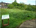
An ARK
The sign reads:
This is an ARK – an Act of Restorative Kindness
An ARK is a haven where our native plants and wildlife can thrive.
It is a place that we leave undisturbed for natural processes to
happen. Space for wildlife is disappearing but, over time, this ARK
will become a safe place for pollinators and other creatures to find
food and shelter.
Image: © Richard Sutcliffe
Taken: 18 May 2022
0.07 miles
5
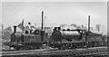
Locomotives in the yard of Stirling (Shore Road, LNER) Depot
View eastwards, from a passing train on the Perth etc. - Glasgow etc. ex-Caledonian main line. The Depot served the LNER (ex-North British) lines, which came to Stirling from Dunfermline and Alloa in the east and from Balloch to the west. In 1947 it had an allocation of 22 engines (2 4-4-0, 15 0-6-0, 2 2-6-2T and 3 0-6-0T), also one steam railcar. It closed on 16/9/57. The two engines in the view were J77 0-6-0T No. 68351 and J35 0-6-0 No. 64520, both ex-NB.
Image: © Ben Brooksbank
Taken: 28 Aug 1948
0.07 miles
6
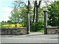
Start of riverside path
The two doric columns appear to have been installed when the path was created in 2009.
Image: © Richard Sutcliffe
Taken: 18 May 2022
0.07 miles
7
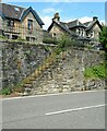
Disused steps
Steps leading from Shore Road up to Forth Crescent. They've been fenced off and clearly disused for a long time.
Image: © Richard Sutcliffe
Taken: 18 May 2022
0.07 miles
8
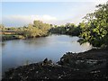
Scrub clearance, Stirling Harbour
Walls and steps have been revealed after some rough woodland was cleared from the site of Stirling's port.
Image: © Richard Webb
Taken: 28 Sep 2012
0.08 miles
9
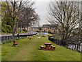
Site of Former Harbour
According to a nearby information board, this grassed area is the site of the former Stirling harbour.
Image: © David Dixon
Taken: 18 Apr 2012
0.09 miles
10
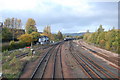
Railway tracks, Stirling
Taken from the road bridge north of Stirling Station.
Image: © Trevor Harris
Taken: 27 Oct 2010
0.09 miles