IMAGES TAKEN NEAR TO
Craighall Street, STIRLING, FK8 1TA
Introduction
This page details the photographs taken nearby to Craighall Street, FK8 1TA by members of the Geograph project.
The Geograph project started in 2005 with the aim of publishing, organising and preserving representative images for every square kilometre of Great Britain, Ireland and the Isle of Man.

There are currently over 7.5m images from over14,400 individuals and you can help contribute to the project by visiting https://www.geograph.org.uk
Image Map
Images are licensed for reuse under creativecommons.org/licenses/by-sa/2.0
Notes
- Clicking on the map will re-center to the selected point.
- The higher the marker number, the further away the image location is from the centre of the postcode.
Image Listing (24 Images Found)
Images are licensed for reuse under creativecommons.org/licenses/by-sa/2.0
Image
Details
Distance
1
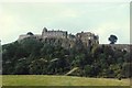
Stirling Castle
Stirling's history has been bloody and the castle on its crag is a stern redoubt. It stood in for Colditz in a 1970s TV series. The castle itself straddles two squares but is seen here from this square, looking east towards the crags.
Image: © Rosalind Mitchell
Taken: Unknown
0.01 miles
2
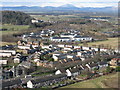
Raploch, and Castle Business Park
Looking over the housing estate, up the Forth Valley towards Ben Ledi, in the centre distance, 27km away.
Image: © M J Richardson
Taken: 23 Feb 2016
0.03 miles
3
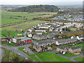
Looking northwest from Stirling Castle
Looking down from the Nether Bailey towards houses at Raploch, the fire station, and the A84 heading towards the M9.
Image: © M J Richardson
Taken: 31 Oct 2011
0.10 miles
4
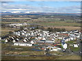
New housing at Raploch
Looking north from Stirling Castle. Forth Valley College is by the river at mid-left.
Image: © M J Richardson
Taken: 23 Feb 2016
0.16 miles
5
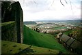
View from Stirling Castle
Looking in a broadly north-westerly direction.
Image: © Jonathan Thacker
Taken: 21 Feb 1998
0.16 miles
6
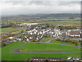
Raploch from Stirling Castle
Looking up the valley of the River Forth from the Nether Bailey of Stirling Castle.
Image: © M J Richardson
Taken: 31 Oct 2011
0.16 miles

8
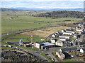
The A84 at Raploch
Looking down from the Nether Bailey of Stirling Castle to Raploch Road and the fire station. The woodland is at Craigforth, just beyond the M9, with Ben Lomond on the distant skyline, about 43km away.
Image: © M J Richardson
Taken: 23 Feb 2016
0.18 miles
9
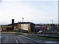
Stirling Fire Station at the south west corner of the Raploch Estate
Image: © Elliott Simpson
Taken: 2 Dec 2012
0.18 miles