
IMAGES TAKEN NEAR TO
Gowanhill Gardens, STIRLING, FK8 1SG
Introduction
This page details the photographs taken nearby to Gowanhill Gardens, FK8 1SG by members of the Geograph project.
The Geograph project started in 2005 with the aim of publishing, organising and preserving representative images for every square kilometre of Great Britain, Ireland and the Isle of Man.

There are currently over 7.5m images from over14,400 individuals and you can help contribute to the project by visiting https://www.geograph.org.uk
Image Map
Images are licensed for reuse under creativecommons.org/licenses/by-sa/2.0
Notes
- Clicking on the map will re-center to the selected point.
- The higher the marker number, the further away the image location is from the centre of the postcode.
Image Listing (108 Images Found)
Images are licensed for reuse under creativecommons.org/licenses/by-sa/2.0
Image
Details
Distance
1
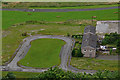
The end of Gowanhill Gardens
The roads remain as the houses in Raploch are demolished.
See Image
Image: © John Allan
Taken: 21 Jul 2012
0.06 miles
2
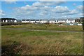
New houses in the Raploch
They are on the site that was shown, a few years earlier, in Image The present view is from beside Back o' Hill Road, and construction was still taking place.
Image: © Lairich Rig
Taken: 25 Aug 2018
0.06 miles
3
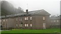
Condemned buildings, Raploch
Some of the old housing stock in Raploch, now being replaced as part of a regeneration scheme.
Image: © Richard Webb
Taken: 25 Oct 2008
0.07 miles
4
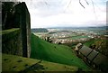
View from Stirling Castle
Looking in a broadly north-westerly direction.
Image: © Jonathan Thacker
Taken: 21 Feb 1998
0.07 miles
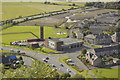
6
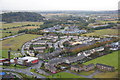
Raploch from Stirling Castle
The fire station is bottom left.
Image: © Mike Pennington
Taken: 17 Oct 2012
0.08 miles
7
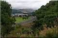
Back O'Hill Road, Stirling
Looking down from the lower end of Ballengeich Road. The new Sainsbury's superstore is ahead, as is the Wallace Monument.
Image: © Bill Boaden
Taken: 9 Aug 2013
0.09 miles
8
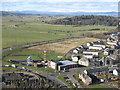
The A84 at Raploch
Looking down from the Nether Bailey of Stirling Castle to Raploch Road and the fire station. The woodland is at Craigforth, just beyond the M9, with Ben Lomond on the distant skyline, about 43km away.
Image: © M J Richardson
Taken: 23 Feb 2016
0.09 miles
9
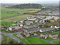
Looking northwest from Stirling Castle
Looking down from the Nether Bailey towards houses at Raploch, the fire station, and the A84 heading towards the M9.
Image: © M J Richardson
Taken: 31 Oct 2011
0.09 miles
10
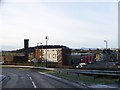
Stirling Fire Station at the south west corner of the Raploch Estate
Image: © Elliott Simpson
Taken: 2 Dec 2012
0.10 miles