
IMAGES TAKEN NEAR TO
Keir Avenue, STIRLING, FK8 1QL
Introduction
This page details the photographs taken nearby to Keir Avenue, FK8 1QL by members of the Geograph project.
The Geograph project started in 2005 with the aim of publishing, organising and preserving representative images for every square kilometre of Great Britain, Ireland and the Isle of Man.

There are currently over 7.5m images from over14,400 individuals and you can help contribute to the project by visiting https://www.geograph.org.uk
Image Map
Images are licensed for reuse under creativecommons.org/licenses/by-sa/2.0
Notes
- Clicking on the map will re-center to the selected point.
- The higher the marker number, the further away the image location is from the centre of the postcode.
Image Listing (77 Images Found)
Images are licensed for reuse under creativecommons.org/licenses/by-sa/2.0
Image
Details
Distance
1
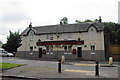
Back O'Hill
A pub on the edge of Raploch.
Image: © Bill Boaden
Taken: 9 Aug 2013
0.13 miles
2

Housing in Raploch
A northern suburb of Stirling as seen from the top of Mote Hill.
Image: © Bill Boaden
Taken: 9 Aug 2013
0.13 miles
3
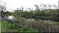
River Forth
High tide on the river - here between Cornton and Raploch, upstream of Stirling Bridge.
Image: © Richard Webb
Taken: 12 May 2012
0.14 miles
4
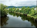
The River Forth
Looking upstream from the famous old bridge on a cool, showery mid-July afternoon.
Image: © Mary and Angus Hogg
Taken: 15 Jul 2012
0.15 miles
5
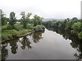
Looking upstream from Old Stirling Bridge
Image: © Eirian Evans
Taken: 7 Sep 2021
0.15 miles
6
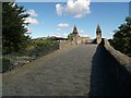
Stirling Old Bridge
This medieval bridge is believed to have been built c.1500.
Image: © Euan Nelson
Taken: 5 Sep 2011
0.16 miles
7
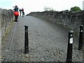
Old Stirling Bridge
The late medieval bridge (believed to be 15th or early 16th century in date) is a Scheduled Monument http://portal.historicenvironment.scot/designation/SM90290. It has been used as a footbridge since the new Stirling Bridge Image was constructed in the 1830s.
Some visitors are looking over towards where the wooden 13th century bridge used to be, which was the site of the Battle of Stirling Bridge in 1297.
Image: © Richard Sutcliffe
Taken: 18 May 2022
0.16 miles
8
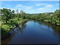
View upriver from Stirling Old Bridge
In this view, the River Forth is seen from Image Although that bridge is centuries old, it did not exist in 1297 when the Battle of Stirling Bridge took place.
The bridge that then existed was only a few metres upriver, in the area shown in the foreground of the present picture. Remains of bridge piers have indeed been found there: see https://canmore.org.uk/site/46113 (at Canmore) for further comments.
Image: © Lairich Rig
Taken: 23 Jun 2018
0.16 miles
9
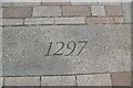
Battle of Stirling Bridge Stone
A stone laid in the ground in the shadow of the auld brig of Stirling to commemorate the battle in 1297 when the Scots army led by William Wallace (later knighted) and Sir Andrew Moray defeated a much larger English army of invasion.
http://en.wikipedia.org/wiki/Battle_of_Stirling_Bridge
Image: © Robert Murray
Taken: 24 Sep 2008
0.16 miles
