
IMAGES TAKEN NEAR TO
Lower Castlehill, STIRLING, FK8 1EN
Introduction
This page details the photographs taken nearby to Lower Castlehill, FK8 1EN by members of the Geograph project.
The Geograph project started in 2005 with the aim of publishing, organising and preserving representative images for every square kilometre of Great Britain, Ireland and the Isle of Man.

There are currently over 7.5m images from over14,400 individuals and you can help contribute to the project by visiting https://www.geograph.org.uk
Image Map
Images are licensed for reuse under creativecommons.org/licenses/by-sa/2.0
Notes
- Clicking on the map will re-center to the selected point.
- The higher the marker number, the further away the image location is from the centre of the postcode.
Image Listing (565 Images Found)
Images are licensed for reuse under creativecommons.org/licenses/by-sa/2.0
Image
Details
Distance
2
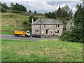
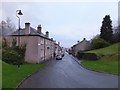
14 Castlehill, Stirling
The last house in the street.
Image: © Andrew Abbott
Taken: 18 Aug 2020
0.02 miles
4
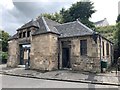
Stirling Distillery
9 Lower Castlehill
Image: © Andrew Abbott
Taken: 18 Aug 2020
0.02 miles
5
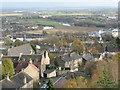
Lower Castlehill, Stirling
Looking down from the French Spur of the Castle, across a large meander of the River Forth to the flat lands of the Carse of Stirling.
Image: © M J Richardson
Taken: 31 Oct 2011
0.02 miles
6
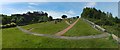
Ballengeich Cemetery
There are no gravestones in the area from which the picture was taken, but there are unmarked graves here. The gap in the wall to the right provides access to the network of paths on Gowan Hill (the Gowan Hill Heritage Trail): see Image, taken only a few metres along the path on the other side of that gap.
In the present picture, Stirling Castle is prominent in the left background, separated from the cemetery by the Pass of Ballengeich.
Image: © Lairich Rig
Taken: 23 Jun 2018
0.04 miles
7
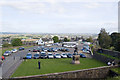
The Esplanade, Stirling Castle
Now serving as the car park...
Image: © Bill Harrison
Taken: 10 Sep 2009
0.04 miles
8
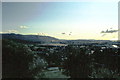
Stirling - 1981
Stirling, Stirling Castle hill, Valley of River Forth, Ochil Hills and Alloa visible in the distance.
Image: © Helmut Zozmann
Taken: Unknown
0.05 miles
9
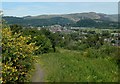
Path on Gowan Hill
A path begins at the gap in the wall that is shown in the right foreground in Image; the path runs parallel to that wall for a few metres before turning right to head NNE. The picture was taken at the start of that part of the path.
Prominent in the right background is the National Wallace Monument (Image) on the Abbey Craig. Behind the Abbey Craig, the highest point on the skyline is Dumyat (in Image; probably "the Dun of the Maeatae").
Image, with its prominent arches, is directly between the viewer and the Wallace Monument; it spans the River Forth. The built-up area behind and to the left of it is mainly Causewayhead, and perhaps also parts of Cornton.
Image: © Lairich Rig
Taken: 23 Jun 2018
0.05 miles
10
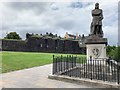
Statue of Robert the Bruce
A statue of Robert the Bruce, designed by George Cruikshank and sculpted by Andrew Currie in 1876-77.
Grade C listed. Listing number LB41120.
Image: © Andrew Abbott
Taken: 18 Aug 2020
0.06 miles