Path on Gowan Hill
Introduction
The photograph on this page of Path on Gowan Hill by Lairich Rig as part of the Geograph project.
The Geograph project started in 2005 with the aim of publishing, organising and preserving representative images for every square kilometre of Great Britain, Ireland and the Isle of Man.

There are currently over 7.5m images from over 14,400 individuals and you can help contribute to the project by visiting https://www.geograph.org.uk
Path on Gowan Hill
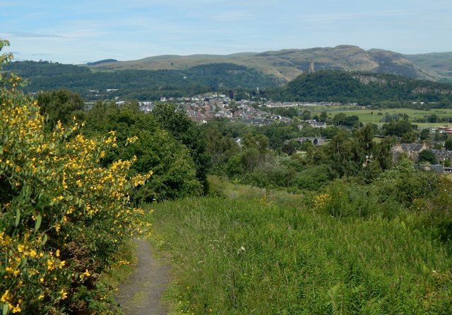
Image: © Lairich Rig Taken: 23 Jun 2018
A path begins at the gap in the wall that is shown in the right foreground in Image; the path runs parallel to that wall for a few metres before turning right to head NNE. The picture was taken at the start of that part of the path. Prominent in the right background is the National Wallace Monument (Image) on the Abbey Craig. Behind the Abbey Craig, the highest point on the skyline is Dumyat (in Image; probably "the Dun of the Maeatae"). Image, with its prominent arches, is directly between the viewer and the Wallace Monument; it spans the River Forth. The built-up area behind and to the left of it is mainly Causewayhead, and perhaps also parts of Cornton.
Images are licensed for reuse under creativecommons.org/licenses/by-sa/2.0
Image Location
Latitude
56.124394
Longitude
-3.944489