
IMAGES TAKEN NEAR TO
King Street, STIRLING, FK8 1AY
Introduction
This page details the photographs taken nearby to King Street, FK8 1AY by members of the Geograph project.
The Geograph project started in 2005 with the aim of publishing, organising and preserving representative images for every square kilometre of Great Britain, Ireland and the Isle of Man.

There are currently over 7.5m images from over14,400 individuals and you can help contribute to the project by visiting https://www.geograph.org.uk
Image Map
Images are licensed for reuse under creativecommons.org/licenses/by-sa/2.0
Notes
- Clicking on the map will re-center to the selected point.
- The higher the marker number, the further away the image location is from the centre of the postcode.
Image Listing (550 Images Found)
Images are licensed for reuse under creativecommons.org/licenses/by-sa/2.0
Image
Details
Distance
1
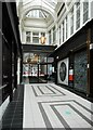
Stirling Arcade
The southwest arcade mall. The arcade was built 1879-1882 and is Category B listed http://portal.historicenvironment.scot/designation/LB41204.
Image: © Richard Sutcliffe
Taken: 18 May 2022
0.00 miles
2
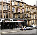
The Boozy Cow
Stirling Arcade stretches from King Street to Murray Place. It is Category B listed http://portal.historicenvironment.scot/designation/LB41204 It dates back to 1882. At the King Street entrance was originally the Temperance Hotel. Since 2016 it has been the Boozy Cow Image
Image: © Gerald England
Taken: 22 Mar 2017
0.01 miles
3
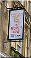
Sign of the Boozy Cow
Sign for the Boozy Cow Image
Image: © Gerald England
Taken: 22 Mar 2017
0.01 miles
4
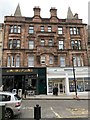
Former Co-operative Society, King Street, Stirling
Now Monterey Jacks and Martin&Go.
Image: © Andrew Abbott
Taken: 18 Aug 2020
0.01 miles
5
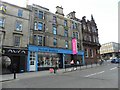
McAree Brothers, Stirling
They are located at King Street - more at http://www.woolandyarn.co.uk/mcaree-brothers-sterling-i139.html
Image: © Kenneth Allen
Taken: 30 Apr 2010
0.01 miles
6
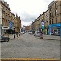
King Street
Looking down the hill from the Athenæum porch.
Image: © Gerald England
Taken: 22 Mar 2017
0.01 miles
7
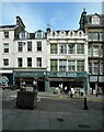
The Ground House and Cafe Aina
The coffee shop on the left is in a late 18th century building, with later dormer windows, which is Category B listed http://portal.historicenvironment.scot/designation/LB41341. The Greek family restaurant on the right with elaborate oval dormers dates from about 1861 and is also Category B listed http://portal.historicenvironment.scot/designation/LB41340.
Image: © Richard Sutcliffe
Taken: 18 May 2022
0.01 miles
8

King Street
Looking down the hill from Corn Exchange Road.
Image: © Thomas Nugent
Taken: 30 Dec 2016
0.01 miles
9
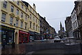
King Street in Stirling
A fine old Scottish city.
Image: © steven ruffles
Taken: 23 Oct 2017
0.01 miles
10

Former Co-operative building (detail)
Carved panel above the first floor of the former Co-operative Society building on King Street. It reads:
CO-OPERATIVE
SOCIETY LIMITED
ESTABLISHED
1880
Image: © Richard Sutcliffe
Taken: 18 May 2022
0.02 miles