
IMAGES TAKEN NEAR TO
Batterflatts Gardens, STIRLING, FK7 9JD
Introduction
This page details the photographs taken nearby to Batterflatts Gardens, FK7 9JD by members of the Geograph project.
The Geograph project started in 2005 with the aim of publishing, organising and preserving representative images for every square kilometre of Great Britain, Ireland and the Isle of Man.

There are currently over 7.5m images from over14,400 individuals and you can help contribute to the project by visiting https://www.geograph.org.uk
Image Map
Images are licensed for reuse under creativecommons.org/licenses/by-sa/2.0
Notes
- Clicking on the map will re-center to the selected point.
- The higher the marker number, the further away the image location is from the centre of the postcode.
Image Listing (13 Images Found)
Images are licensed for reuse under creativecommons.org/licenses/by-sa/2.0
Image
Details
Distance
1
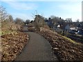
Path around the edge of King's Park
This is a visible reminder that the park has an escarpment(*) on all sides but the east, although it rapidly loses height alongside this part of the path. A large building seen indistinctly near the centre of the picture is Laurel House.
(*) For the escarpment, see, for example, Image (north), Image (west), and Image (south). For the geological reason, see Image
Image: © Lairich Rig
Taken: 24 Feb 2018
0.12 miles
2
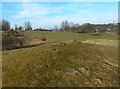
Rocky knolls in King's Park
This part of the path is at the top of a steep rocky escarpment: Image / Image It is therefore little wonder that there are some igneous outcrops scattered around. Stirling Castle is on higher ground in the right background.
Image: © Lairich Rig
Taken: 24 Feb 2018
0.16 miles
3
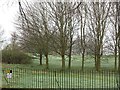
King's Park
A large park which gave its name to a former football club.
Image: © Richard Webb
Taken: 23 Mar 2012
0.18 miles
4
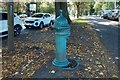
Old drinking fountain
This one, beside Park Avenue, is the most southerly of the four fountains. It has a carved lion's head.
Image: © Lairich Rig
Taken: 21 Sep 2019
0.20 miles
5
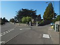
Junction of Birkhill Road and Douglas Terrace
This junction is depicted on the 1:25000 and 1:50000 maps. Douglas Terrace is the road branching off to the right. The building in the angle is Cliffside (1866, B-listed).
Image: © Lairich Rig
Taken: 21 Sep 2019
0.20 miles
6
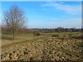
King's Park
As the map and the picture show, much of the park is a golf course.
Image: © Lairich Rig
Taken: 24 Feb 2018
0.20 miles
7
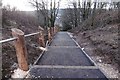
New path, King's Park
Construction of a tarred path in an otherwise very muddy park. The path ascends a gap in the crags on the scarp slope of a small hill.
Image: © Richard Webb
Taken: 1 Feb 2017
0.20 miles
8
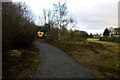
Path construction, King's Park
A hard path is being built up the scarp slope from Douglas Terrace. Paths in the park are rather muddy.
Image: © Richard Webb
Taken: 1 Feb 2017
0.21 miles
9
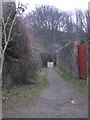
Path to King's Park
Path from Douglas Terrace leading to the King's Park golf course.
Image: © Callum Black
Taken: 24 Mar 2006
0.21 miles
10
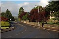
Birkhill Road
Birkhill Road is on the western side of Stirling. It joins Park Place to St. Ninian's Road.
Image: © Paul McIlroy
Taken: 12 Aug 2007
0.21 miles