IMAGES TAKEN NEAR TO
Laxdale Drive, DENNY, FK6 5PR
Introduction
This page details the photographs taken nearby to Laxdale Drive, FK6 5PR by members of the Geograph project.
The Geograph project started in 2005 with the aim of publishing, organising and preserving representative images for every square kilometre of Great Britain, Ireland and the Isle of Man.

There are currently over 7.5m images from over14,400 individuals and you can help contribute to the project by visiting https://www.geograph.org.uk
Image Map
Images are licensed for reuse under creativecommons.org/licenses/by-sa/2.0
Notes
- Clicking on the map will re-center to the selected point.
- The higher the marker number, the further away the image location is from the centre of the postcode.
Image Listing (4 Images Found)
Images are licensed for reuse under creativecommons.org/licenses/by-sa/2.0
Image
Details
Distance
4
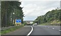
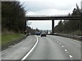
Bridge over the M80
Heading into Head of Muir - or at least the kinda no mans land between it and the southern outskirts of Denny. Housing developments tend to spread into areas with no real place-name.
Image: © Robert Murray
Taken: 17 Apr 2011
0.20 miles