
IMAGES TAKEN NEAR TO
Quintinshill Drive, FK5 4ZZ
Introduction
This page details the photographs taken nearby to Quintinshill Drive, FK5 4ZZ by members of the Geograph project.
The Geograph project started in 2005 with the aim of publishing, organising and preserving representative images for every square kilometre of Great Britain, Ireland and the Isle of Man.

There are currently over 7.5m images from over14,400 individuals and you can help contribute to the project by visiting https://www.geograph.org.uk
Image Map
Images are licensed for reuse under creativecommons.org/licenses/by-sa/2.0
Notes
- Clicking on the map will re-center to the selected point.
- The higher the marker number, the further away the image location is from the centre of the postcode.
Image Listing (42 Images Found)
Images are licensed for reuse under creativecommons.org/licenses/by-sa/2.0
Image
Details
Distance
1
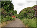
Road, Larbert House
Now closed and no longer used by vehicles, this road is being lost to the rhododendron.
Image: © Richard Webb
Taken: 23 Jun 2010
0.01 miles
2
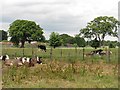
Cattle, Larbert
A field beside two of the old roads serving Larbert House.
Image: © Richard Webb
Taken: 23 Jun 2010
0.02 miles
3
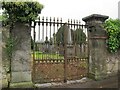
Entrance to Old Parish Churchyard
These wrought iron gates provide an entrance to the churchyard from Denny Road, but have not been opened for some time.
Image: © Richard Dorrell
Taken: 19 Oct 2021
0.07 miles
4
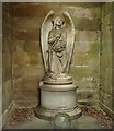
Statue from within Dawson Family Mausoleum
Angel of the Resurrection.
"Carved out of a speckled block of white marble, the statue rests on a low basement of bluish grey Sicilian, harmonising in style with the architecture of the mausoleum. The figure, which is on a scale somewhat larger than life, has been designed in a sitting posture, body and limbs being draped in a loose robe, through which the contours are freely expressed. The right hand grasps a straight trumpet, which is held in a diagonal position across the breast, while the left rests easily on a closed book lying upon the lap. The head is held erect, with an upward look that indicates expectancy, and with this the whole attitude happily corresponds, the disposition of the lower limbs bespeaking readiness to rise on the giving of the watched-for signal."
History of Stirlingshire Chapter XIX. Larbert
See here www.geograph.org.uk/photo/1834551 for further context.
Image: © Texas Radio and The Big Beat
Taken: 23 Aug 2011
0.07 miles

6
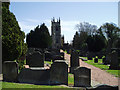
Larbert Old Parish Church
This beautiful Church was designed by David Hamilton and construction began in the 1820's. It sits high above the Carron Valley and is a well known Landmark in the area. It also has a beautiful well kept Graveyard with many fine monuments and tombs including one to Sir James Bruce of Kinnaird who discovered the source of The Blue Nile.
Image: © Kevin Rae
Taken: 29 Apr 2006
0.08 miles
7
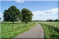
Road to Larbert House
Looking back along the road towards the church.
Image: © Texas Radio and The Big Beat
Taken: 12 Sep 2010
0.09 miles
8
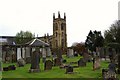
Larbert Old Church and Churchyard
Image: © Texas Radio and The Big Beat
Taken: 1 May 2010
0.09 miles
9
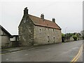
Old Manse, Larbert
Located in Denny Road. The building is dated 1635, and was restored in 1955, when the pantile roof was installed.
Image: © Richard Dorrell
Taken: 19 Oct 2021
0.10 miles
10
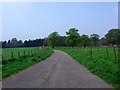
Larbert House Drive
The driveway or avenue to the now ruined Larbert House.
Image: © Robert Murray
Taken: 22 Apr 2011
0.11 miles