
IMAGES TAKEN NEAR TO
Stirling Road, LARBERT, FK5 4WR
Introduction
This page details the photographs taken nearby to Stirling Road, FK5 4WR by members of the Geograph project.
The Geograph project started in 2005 with the aim of publishing, organising and preserving representative images for every square kilometre of Great Britain, Ireland and the Isle of Man.

There are currently over 7.5m images from over14,400 individuals and you can help contribute to the project by visiting https://www.geograph.org.uk
Image Map
Images are licensed for reuse under creativecommons.org/licenses/by-sa/2.0
Notes
- Clicking on the map will re-center to the selected point.
- The higher the marker number, the further away the image location is from the centre of the postcode.
Image Listing (14 Images Found)
Images are licensed for reuse under creativecommons.org/licenses/by-sa/2.0
Image
Details
Distance
1
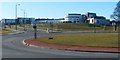
Forth Valley Royal Hospital
When the photograph was taken, this 860-bed hospital was still under construction (under the name of the Forth Valley Acute Hospital Project). However, a topping out ceremony (the symbolic laying of the top slab of the building) had already taken place on the 25th of March, 2009, with the First Minister of Scotland, Alex Salmond MSP, as the guest of honour.
Although the hospital is expected to receive patients from 2010 onwards, construction of all the buildings on this site is likely to be completed by 2011. There were also plans to create a woodland park in the surrounding area.
The new hospital is intended to replace (eventually) Stirling Royal Infirmary and Falkirk District Royal Infirmary. It was granted royal status on the 15th of January, 2010, resulting in a change of name to Forth Valley Royal Hospital.
[The photograph was taken from the A9. The construction site happens to be located at an intersection of grid lines, and so lies within four different grid squares; its centre was used as the subject location.]
For another view, by a different contributor, see Image
Image: © Lairich Rig
Taken: 1 Mar 2010
0.02 miles
2
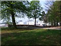
Forth Valley Royal Hospital
From the grounds of Larbert House.
Image: © Robert Murray
Taken: 22 Apr 2011
0.11 miles
3
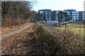
Footpath to Larbert
After the long straight section shown in Image, the road turns to the right (see the map) and heads SE for about 150 metres. That part of the road is shown here; the photograph was taken from the turning. After that, it turns left to resume its previous direction, and follows Old Denny Road: Image
Although still open as a footpath, this part of the road was closed to traffic as a result of construction work taking place on the new Image, which is visible on the right.
Image: © Lairich Rig
Taken: 1 Mar 2010
0.14 miles
4
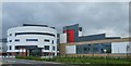
Forth Valley Royal Hospital
The new FVRH opens in August 2010.
Image: © jamesnicoll
Taken: 16 Jul 2010
0.14 miles
5
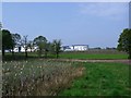
Larbert House Policies
Looking along the bank of the lake towards the new Forth Valley Royal Hospital.
Image: © Robert Murray
Taken: 22 Apr 2011
0.17 miles
6
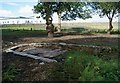
Larbert House Ornamental Loch "Dock"
"Dock" is possibly and probably not the correct word.
It's basically where the people would get in and out of the boats
and where the boats would be tied. The level of the loch has obviously
dropped considerably as this structure is now many yards from the water.
Image: © Texas Radio and The Big Beat
Taken: 12 Sep 2010
0.17 miles
7
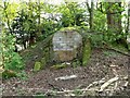
Larbert Estate, ice house
Long since bricked up.
Image: © Robert Murray
Taken: 22 Apr 2011
0.17 miles
8
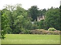
Larbert House
A glimpse of the ruins of Larbert House from the A9.
Image: © Richard Webb
Taken: 23 Jun 2010
0.21 miles
9
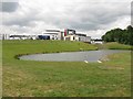
Forth Valley Royal Hospital
Landscaping in the grounds of the new hospital. The hospital is easily accessible from the motorway, as long as you have your emergency south and west of Larbert. They do like their limited access motorway junctions around here.
I am not sure if it is open yet - there is still work going on, but this area is no longer subject to building site security.
Image: © Richard Webb
Taken: 23 Jun 2010
0.21 miles
10
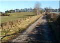
Footpath to Larbert
The field on the left separates the footpath from the motorway. On the other side of the fence that is visible at the right-hand edge of the photograph, a hospital was under construction: Image
Not far ahead, the path turns to the right, as indicated on the map: Image
Image: © Lairich Rig
Taken: 1 Mar 2010
0.21 miles