IMAGES TAKEN NEAR TO
Castlehill Crescent, BONNYBRIDGE, FK4 1JS
Introduction
This page details the photographs taken nearby to Castlehill Crescent, FK4 1JS by members of the Geograph project.
The Geograph project started in 2005 with the aim of publishing, organising and preserving representative images for every square kilometre of Great Britain, Ireland and the Isle of Man.

There are currently over 7.5m images from over14,400 individuals and you can help contribute to the project by visiting https://www.geograph.org.uk
Image Map
Images are licensed for reuse under creativecommons.org/licenses/by-sa/2.0
Notes
- Clicking on the map will re-center to the selected point.
- The higher the marker number, the further away the image location is from the centre of the postcode.
Image Listing (13 Images Found)
Images are licensed for reuse under creativecommons.org/licenses/by-sa/2.0
Image
Details
Distance
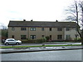
1
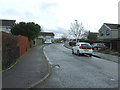
Laburnum Road, Banknock
Looking south east.
Image: © JThomas
Taken: 30 Mar 2017
0.13 miles
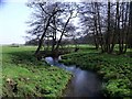
3
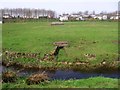
Banknock, fields
The Bonny Water in the foreground with what looks like an overflow conduit from a water treatment plant or drainage sump visible in the distance.
Image: © Robert Murray
Taken: 9 Apr 2011
0.21 miles
4
Banknock, the Auchincloch Burn
Just before its confluence with the Red Burn.
Image: © Robert Murray
Taken: 9 Apr 2011
0.23 miles
5
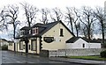
The Hollandbush Inn, Banknock
Image: © Texas Radio and The Big Beat
Taken: 25 Apr 2010
0.24 miles
6
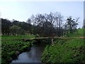
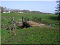
Banknock, the Bonny Water
Where two bridges cross. One an agricultural and the other a pedestrian footbridge linking Banknock with the Forth & Clyde canal towpath.
Image: © Robert Murray
Taken: 9 Apr 2011
0.24 miles
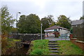
7
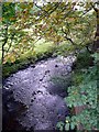
The Red Burn goes under the Forth and Clyde Canal
Shortly to join the Bonny Water (lovely name!).
Image: © Gordon Brown
Taken: 14 Oct 2008
0.24 miles
9
Banknock Store, Bog Road, Banknock
The stream is Doups Burn
Image: © Tim Heaton
Taken: 9 Oct 2018
0.24 miles