IMAGES TAKEN NEAR TO
Larch Drive, BONNYBRIDGE, FK4 1HW
Introduction
This page details the photographs taken nearby to Larch Drive, FK4 1HW by members of the Geograph project.
The Geograph project started in 2005 with the aim of publishing, organising and preserving representative images for every square kilometre of Great Britain, Ireland and the Isle of Man.

There are currently over 7.5m images from over14,400 individuals and you can help contribute to the project by visiting https://www.geograph.org.uk
Image Map
Images are licensed for reuse under creativecommons.org/licenses/by-sa/2.0
Notes
- Clicking on the map will re-center to the selected point.
- The higher the marker number, the further away the image location is from the centre of the postcode.
Image Listing (15 Images Found)
Images are licensed for reuse under creativecommons.org/licenses/by-sa/2.0
Image
Details
Distance
1
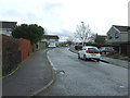
Laburnum Road, Banknock
Looking south east.
Image: © JThomas
Taken: 30 Mar 2017
0.12 miles
3
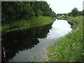
Forth and Clyde Canal West of Banknock
The canal takes a bend towards the west to embark on prolonged straight section.
Image: © Chris Heaton
Taken: 10 Aug 2009
0.17 miles
4
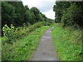
Forth and Clyde Canal South of Banknock
The canal is screened by trees as it passes close to the community of Banknock.
Image: © Chris Heaton
Taken: 10 Aug 2009
0.18 miles
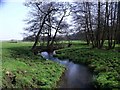
5
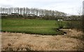
Bonny Water
The burn meanders here between semi-improved and unimproved grassland. In the distance, behind a row of trees, are some houses on the edge of Banknock.
Image: © Richard Sutcliffe
Taken: 21 Mar 2020
0.18 miles
6
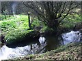
Auchincloch Burn and county boundary
The fence post to the left is Falkirk-shire (or whatever it is called) and the tree on the right of the barely discernable ditch is North Lanarkshire.
The aforementioned mostly filled in ditch between the two is the visible remains of the old course of the Red Burn as it was here that the natural confluence took place until the Resident Engineer Robert Mackell building the Forth & Clyde canal diverted the course of the Red Burn in 1770 as described in Image
Image: © Robert Murray
Taken: 9 Apr 2011
0.20 miles
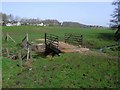
7
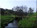
Banknock, the Bonny Water
Where two bridges cross. One an agricultural and the other a pedestrian footbridge linking Banknock with the Forth & Clyde canal towpath.
Image: © Robert Murray
Taken: 9 Apr 2011
0.20 miles
8
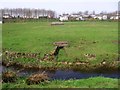
Banknock, fields
The Bonny Water in the foreground with what looks like an overflow conduit from a water treatment plant or drainage sump visible in the distance.
Image: © Robert Murray
Taken: 9 Apr 2011
0.21 miles
10
Banknock, the Auchincloch Burn
Just before its confluence with the Red Burn.
Image: © Robert Murray
Taken: 9 Apr 2011
0.22 miles