
IMAGES TAKEN NEAR TO
Kerse Road, GRANGEMOUTH, FK3 9DU
Introduction
This page details the photographs taken nearby to Kerse Road, FK3 9DU by members of the Geograph project.
The Geograph project started in 2005 with the aim of publishing, organising and preserving representative images for every square kilometre of Great Britain, Ireland and the Isle of Man.

There are currently over 7.5m images from over14,400 individuals and you can help contribute to the project by visiting https://www.geograph.org.uk
Image Map
Images are licensed for reuse under creativecommons.org/licenses/by-sa/2.0
Notes
- Clicking on the map will re-center to the selected point.
- The higher the marker number, the further away the image location is from the centre of the postcode.
Image Listing (35 Images Found)
Images are licensed for reuse under creativecommons.org/licenses/by-sa/2.0
Image
Details
Distance
1
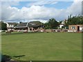
Bowls Club
There is no risk of running out of milk for the tea as the club is right next to a supermarket.
Image: © Tom Sargent
Taken: 31 Aug 2007
0.04 miles
2
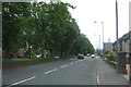
Abbots Road, Grangemouth
Looking south west on the B9132.
Image: © JThomas
Taken: 21 Jun 2017
0.07 miles
5
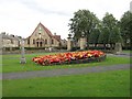
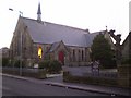
Entrance, Zetland Park
Flowerbed in front of the entrance off Dalratho Road. The church is Christ the King & Sacred Heart (RC).
Image: © Richard Webb
Taken: 4 Sep 2009
0.11 miles
6
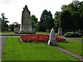
Grangemouth War Memorial
Situated at the northern entrance to Zetland Park, the sandstone and limestone cenotaph was unveiled in 1923. On top of the cenotaph there is a sculpture of a British lion eating a German eagle. The war memorial is a Category B listed building. https://www.britishlistedbuildings.co.uk/200406355-war-memorial-grangemouth#.Wb1JEjGWw5s
Image: © G Laird
Taken: 14 Sep 2017
0.11 miles
7
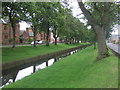
Grange Burn
Runs in a channel at this point.
Looking south west.
Image: © JThomas
Taken: 21 Jun 2017
0.11 miles
8
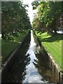
Grange burn
For human convenience this burn does not flow free but is restricted by artificial banks.
Image: © Tom Sargent
Taken: 31 Aug 2007
0.13 miles
9
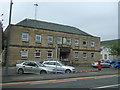
Grangemouth Police Station
On Bo'ness Road.
Showing position of Postbox No. FK3 113.
See Image] for postbox.
Image: © JThomas
Taken: 21 Jun 2017
0.15 miles
10
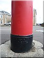
Carron Company pillar box detail, Bo'ness Road
A pillar box made close to home at the Carron Company's ironworks outside Falkirk. Carron was one of several foundries that produced the Royal Mail's red and black pillar boxes, as well as the classic red telephone booths designed by Sir Giles Gilbert Scott.
Image: © kim traynor
Taken: 12 Aug 2010
0.15 miles