
IMAGES TAKEN NEAR TO
Paris Street, GRANGEMOUTH, FK3 9BN
Introduction
This page details the photographs taken nearby to Paris Street, FK3 9BN by members of the Geograph project.
The Geograph project started in 2005 with the aim of publishing, organising and preserving representative images for every square kilometre of Great Britain, Ireland and the Isle of Man.

There are currently over 7.5m images from over14,400 individuals and you can help contribute to the project by visiting https://www.geograph.org.uk
Image Map
Images are licensed for reuse under creativecommons.org/licenses/by-sa/2.0
Notes
- Clicking on the map will re-center to the selected point.
- The higher the marker number, the further away the image location is from the centre of the postcode.
Image Listing (13 Images Found)
Images are licensed for reuse under creativecommons.org/licenses/by-sa/2.0
Image
Details
Distance
1
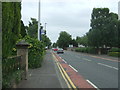
Bus stop on Bo'ness Road, Grangemouth
Looking south east.
Image: © JThomas
Taken: 21 Jun 2017
0.06 miles
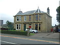
3
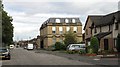
Grangeburn Road
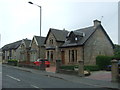
Older larger building amongst more modern housing. The road runs beside the canalised Grange Burn.
Image: © Richard Webb
Taken: 4 Sep 2009
0.09 miles
4
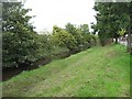
Grange Burn
Canalised flood menace and part of an elaborate protection scheme for this very low lying town. The burn separates residential areas from the docks.
Image: © Richard Webb
Taken: 4 Sep 2009
0.09 miles
5
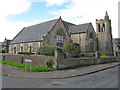
Zetland Parish Church, Grangemouth
Situated on Ronaldshay Crescent and to the north of Zetland Park, the foundation stone of this large church was laid 1910. The church is a Category B listed building. https://www.britishlistedbuildings.co.uk/200378255-grangemouth-ronaldshay-crescent-old-parish-church-grangemouth#.Wb1NSTGWw5s
Image: © G Laird
Taken: 14 Sep 2017
0.17 miles
6
South Shore Road, Grangemouth
Looking north east.
Image: © JThomas
Taken: 21 Jun 2017
0.17 miles
7
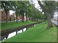
Grange Burn
Runs in a channel at this point.
Looking south west.
Image: © JThomas
Taken: 21 Jun 2017
0.20 miles
8
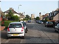
Oswald Drive, Grangemouth
You can smell the petrochemical works too.
Image: © Richard Webb
Taken: 15 Sep 2011
0.21 miles
10
View towards Grangemouth
A view from Castle Campbell in Dollar towards the refinery at Grangemouth roughly 17km distant. The chimney at Longannet power station is also visible through the low cloud.
Image: © William Starkey
Taken: 9 Feb 2016
0.24 miles