
IMAGES TAKEN NEAR TO
Tinto Drive, GRANGEMOUTH, FK3 0DX
Introduction
This page details the photographs taken nearby to Tinto Drive, FK3 0DX by members of the Geograph project.
The Geograph project started in 2005 with the aim of publishing, organising and preserving representative images for every square kilometre of Great Britain, Ireland and the Isle of Man.

There are currently over 7.5m images from over14,400 individuals and you can help contribute to the project by visiting https://www.geograph.org.uk
Image Map
Images are licensed for reuse under creativecommons.org/licenses/by-sa/2.0
Notes
- Clicking on the map will re-center to the selected point.
- The higher the marker number, the further away the image location is from the centre of the postcode.
Image Listing (17 Images Found)
Images are licensed for reuse under creativecommons.org/licenses/by-sa/2.0
Image
Details
Distance
1
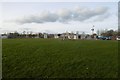
School playing fields, Bowhouse
Off Tinto Drive.
Image: © Richard Webb
Taken: 9 Mar 2017
0.03 miles
2
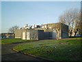
Bowhouse pumping station
Much of Grangemouth is very low lying with a high water table. Assistance is sometimes needed.
Image: © Tom Sargent
Taken: 27 Dec 2008
0.05 miles
3
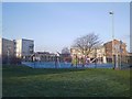
Bowhouse play area
A group of parents have taken responsibility for much of the running of this playpark. Note the Solar panel to the right.
Image: © Tom Sargent
Taken: 27 Dec 2008
0.09 miles
5
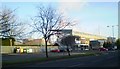
Athletic Stadium, Grangemouth
In the rear of the photograph can be seen reaction vessels and steam from the chemical industry which surrounds Grangemouth.
Image: © Tom Sargent
Taken: 27 Dec 2008
0.15 miles
6
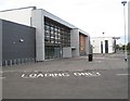
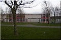
Grangemouth High School
Grangemouth High School moved into these new buildings in January 2009. The adjacent old school buildings have since been demolished.
Image: © Richard Webb
Taken: 4 Sep 2009
0.15 miles
8
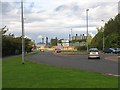
Inchyra Road
One of the roads linking the oil refinery, polymer plants and docks with the M9 motorway. A lot of Scotland's trade and almost all the road fuel passes this way. I expect by surveying the traffic here, you could get a very good idea of how well the economy is doing.
The roads in the petrochemical complex are straight and this may be due to the alignment of the runway on the airport that used to occupy this site.
Image: © Richard Webb
Taken: 4 Sep 2009
0.16 miles
9
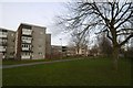
Cultenhove Crescent, Grangemouth
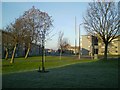
On the outside, looking in from a strip of open land between the flats and school grounds.
Image: © Richard Webb
Taken: 9 Mar 2017
0.17 miles
10
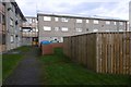
Cultenhove Crescent, Grangemouth
Behind the flats with wooden fences around drying greens.
Image: © Richard Webb
Taken: 9 Mar 2017
0.17 miles