
IMAGES TAKEN NEAR TO
Grant Grove, FALKIRK, FK2 9FS
Introduction
This page details the photographs taken nearby to Grant Grove, FK2 9FS by members of the Geograph project.
The Geograph project started in 2005 with the aim of publishing, organising and preserving representative images for every square kilometre of Great Britain, Ireland and the Isle of Man.

There are currently over 7.5m images from over14,400 individuals and you can help contribute to the project by visiting https://www.geograph.org.uk
Image Map
Images are licensed for reuse under creativecommons.org/licenses/by-sa/2.0
Notes
- Clicking on the map will re-center to the selected point.
- The higher the marker number, the further away the image location is from the centre of the postcode.
Image Listing (14 Images Found)
Images are licensed for reuse under creativecommons.org/licenses/by-sa/2.0
Image
Details
Distance
2
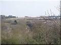
Callendar Rise
Huge housing development southwest of Redding. The railway runs between Falkirk Grahamston and Polmont and serves Edinburgh and Stirling.
Image: © Richard Webb
Taken: 3 Apr 2009
0.18 miles
4
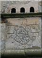
Heraldic Panel
The panel bears the date 1647, and is built into the front of the doocot at Westquarter, but is probably much earlier than the doocot itself. The arms are those of Livingstone of Westquarter and the letters denote Sir William Livingstone and his wife Dame Helenore Livingstone.
Image: © Anne Burgess
Taken: 5 Oct 2013
0.19 miles
5
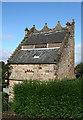
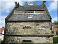
Westquarter Doocot
The doocot is thought to date from the 18th century, incorporating a Image] dated 1647. The building is 18 feet 3 inches by 16 feet 3 inches (5.56 x 4.95 metres) and the rubble walls are 2 feet 10 inches (0.86 metres) thick. The roof has been renewed but the rest is original,including the scalloped roof top and ball finials. The doocot is a Category A Listed building and is in the care of Historic Scotland. I was amused to see that the hedge to the left of the gate has been neatly trimmed, but the man with the hedge trimmer has yet to work his way round to the right of the gate!
Image: © Anne Burgess
Taken: 5 Oct 2013
0.19 miles
6
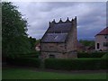
Westquarter Dovecote
Built for the long demolished Westquarter House some 150 years ago this building is a little out of place in a modern estate.
Image: © Tom Sargent
Taken: 7 May 2009
0.22 miles
7
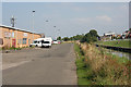
Redding Industrial Estate
For a short distance here the canal emerges from its quiet leafy course and passes alongside the units that make up the small industrial estate - perhaps a hint of the industry that once the canal depended on?
Image: © Anne Burgess
Taken: 26 Aug 2013
0.22 miles
8
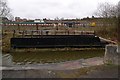
Swing bridge on Union Canal
This small swing bridge once provided access to the Nobel munitions factory at Reddingmuirhead on the far bank.
The site is being redeveloped for housing now.
Image: © Rob Burke
Taken: 4 Apr 2009
0.23 miles
9
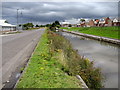
Union Canal west of Redding
West of Redding and HM Young Offenders Facility the canal loses its towpath temporarily, having been adopted by a road that serves an industrial estate.
Image: © Chris Heaton
Taken: 9 Aug 2009
0.23 miles
10
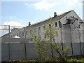
Polmont Young Offenders institution
This is old part of original Borstal gradually being replaced with more modern accommodation to house some of Scotland's high profile under 21 criminals
Image: © paul birrell
Taken: 10 Jun 2005
0.23 miles