
IMAGES TAKEN NEAR TO
Millrow, DUNBLANE, FK15 0EL
Introduction
This page details the photographs taken nearby to Millrow, FK15 0EL by members of the Geograph project.
The Geograph project started in 2005 with the aim of publishing, organising and preserving representative images for every square kilometre of Great Britain, Ireland and the Isle of Man.

There are currently over 7.5m images from over14,400 individuals and you can help contribute to the project by visiting https://www.geograph.org.uk
Image Map
Images are licensed for reuse under creativecommons.org/licenses/by-sa/2.0
Notes
- Clicking on the map will re-center to the selected point.
- The higher the marker number, the further away the image location is from the centre of the postcode.
Image Listing (526 Images Found)
Images are licensed for reuse under creativecommons.org/licenses/by-sa/2.0
Image
Details
Distance
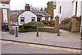
2
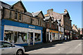
Mary's Meals, High Street, Dunblane
Charity shop in a Category C listed building [http://portal.historicenvironment.scot/designation/LB48952] dating from 1881, but with 17th century foundations.
Image: © Richard Sutcliffe
Taken: 24 May 2018
0.01 miles
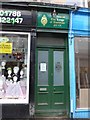
4
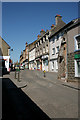
Tenements, High Street, Dunblane
Numbers 30, 32 and 34 are Category C listed [http://portal.historicenvironment.scot/designation/LB48957].
Image: © Richard Sutcliffe
Taken: 24 May 2018
0.01 miles
5
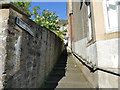
Town Mill Stair, Dunblane
The steps lead from Millrow up to High Street.
Image: © Stephen Craven
Taken: 27 Jun 2019
0.02 miles
6

22 and 24 High Street, Dunblane
Category C listed [http://portal.historicenvironment.scot/designation/LB26398] buildings dating from 1726, but much altered.
Image: © Richard Sutcliffe
Taken: 24 May 2018
0.03 miles
7
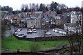
Millrow car park
Viewed from the footbridge at Bridgend.
Image: © Thomas Nugent
Taken: 2 Jan 2013
0.03 miles
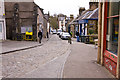
9
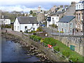
Dunblane from the Bridge
Allan Water with vernacular stone buildings at the back of the High Street. In the distance is the Dunblane Cathedral.
Image: © Colin Smith
Taken: 25 Mar 2008
0.03 miles
10
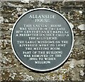
Allanside House Plaque
On the wall beside Allanside House Image
ALLANSIDE
HOUSE
THIS UNUSUAL HOUSE
WAS USED FROM THE LATE
18TH CENTURY AS A CHAPEL BY
A PRESBYTERIAN SECT CALLED
THE AULD LIGHT.
THE LARGE WINDOWS ON THE
RIVERSIDE WERE TO LIGHT
THE MEETING ROOM.
PART OF THE BUILDING
WAS REMOVED IN THE
1950S TO WIDEN
MILLROW.
Image: © Richard Sutcliffe
Taken: 29 Apr 2022
0.03 miles