Allanside House Plaque
Introduction
The photograph on this page of Allanside House Plaque by Richard Sutcliffe as part of the Geograph project.
The Geograph project started in 2005 with the aim of publishing, organising and preserving representative images for every square kilometre of Great Britain, Ireland and the Isle of Man.

There are currently over 7.5m images from over 14,400 individuals and you can help contribute to the project by visiting https://www.geograph.org.uk
Allanside House Plaque
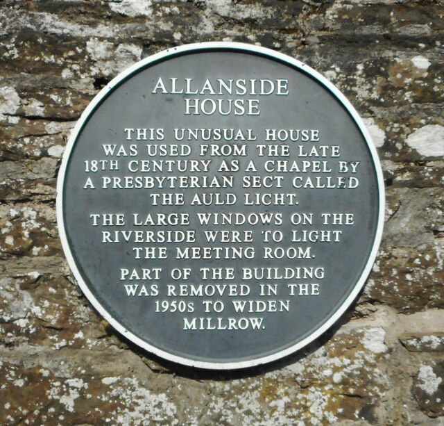
Image: © Richard Sutcliffe Taken: 29 Apr 2022
On the wall beside Allanside House Image ALLANSIDE HOUSE THIS UNUSUAL HOUSE WAS USED FROM THE LATE 18TH CENTURY AS A CHAPEL BY A PRESBYTERIAN SECT CALLED THE AULD LIGHT. THE LARGE WINDOWS ON THE RIVERSIDE WERE TO LIGHT THE MEETING ROOM. PART OF THE BUILDING WAS REMOVED IN THE 1950S TO WIDEN MILLROW.
Images are licensed for reuse under creativecommons.org/licenses/by-sa/2.0
Image Location
Latitude
56.186979
Longitude
-3.964736