
IMAGES TAKEN NEAR TO
Mountbatten Close, EXMOUTH, EX8 4DJ
Introduction
This page details the photographs taken nearby to Mountbatten Close, EX8 4DJ by members of the Geograph project.
The Geograph project started in 2005 with the aim of publishing, organising and preserving representative images for every square kilometre of Great Britain, Ireland and the Isle of Man.

There are currently over 7.5m images from over14,400 individuals and you can help contribute to the project by visiting https://www.geograph.org.uk
Image Map
Images are licensed for reuse under creativecommons.org/licenses/by-sa/2.0
Notes
- Clicking on the map will re-center to the selected point.
- The higher the marker number, the further away the image location is from the centre of the postcode.
Image Listing (11 Images Found)
Images are licensed for reuse under creativecommons.org/licenses/by-sa/2.0
Image
Details
Distance
1
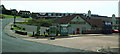
The Farmhouse, Brixington
This pub is situated next door to the service station in Brixington. On the horizon can be seen the flats above another group of local shops.
Image: © Mike Crowe
Taken: 18 Jun 2005
0.16 miles
2
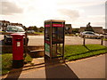
Exmouth: postbox № EX8 605, Brixington shops
This postbox is at Image, facing the door of the post office, on which a handwritten notice explained that the office would be closed this Saturday morning as well as the upcoming bank holiday Monday. The box is emptied finally on weekdays at 6pm and on Saturdays at 12:15pm.
Image: © Chris Downer
Taken: 29 Aug 2009
0.18 miles
3
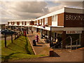
Exmouth: Brixington shops
A shopping parade in suburban Exmouth, comprising all the likely candidates: post office, general store, hairdresser, vacant premises – and the not so predictable stockist of wheelchairs and other mobility aids, nearest the camera.
Image: © Chris Downer
Taken: 29 Aug 2009
0.18 miles
4
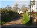
Southern end of Marcus Road
Marcus Road is an unadopted road which joins St Johns Road with Brixington Lane. Plans have been submitted (2009) to develop the land on the left and realign the road, so this view is likely to change in the near future.
Image: © Kate Burhouse
Taken: 30 Nov 2009
0.20 miles
5
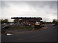
Tesco Express petrol station
Churchill Road,Brixington.
Formerly a BP station. Owned by Safeway. Image
Image: © Anthony Vosper
Taken: 16 Nov 2015
0.22 miles
6
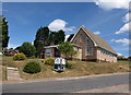
Brixington Community Church
This Baptist church set above Churchill Road opened in 1973, after considerable financial struggle http://www.bcc.saxton.org.uk/html/history.html .
Image: © Derek Harper
Taken: 9 Jul 2010
0.22 miles
7
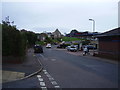
Churchill Road, Brixington
On the right Tesco Express filling station and in the distance on the left Brixington Community Church.
Image: © Anthony Vosper
Taken: 16 Nov 2015
0.22 miles
8
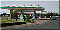
Bp Garage and store, Brixington
Owned by Safeway, this garage is in Brixington, Exmouth, in the heart of a residential area.
Image: © Mike Crowe
Taken: 18 Jun 2005
0.22 miles
9
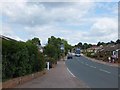
Brixington Lane
Only the name remains to remind one that this was once farmland
Image: © David Smith
Taken: 1 Jul 2011
0.23 miles
10
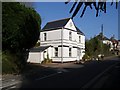
Stoke Lyne Cottage
This cottage was one of the few buildings in St Johns Road when the 1:2500 map was surveyed in 1889. It may be the same cottage shown on the 1840 tithe map, occupied by Thomas PRIDDIS. By 1952 the house is labelled 'Blue Haze' and now it is simply known as 25, St Johns Road.
The path beside the cottage was originally the southern end of the lane leading up to Brixington, now Brixington Lane. When Forton Road was built in the 1930s this part of the lane was made into a footpath.
Image: © Kate Burhouse
Taken: 30 Nov 2009
0.23 miles