
IMAGES TAKEN NEAR TO
Exeter Road, DAWLISH, EX7 0AH
Introduction
This page details the photographs taken nearby to Exeter Road, EX7 0AH by members of the Geograph project.
The Geograph project started in 2005 with the aim of publishing, organising and preserving representative images for every square kilometre of Great Britain, Ireland and the Isle of Man.

There are currently over 7.5m images from over14,400 individuals and you can help contribute to the project by visiting https://www.geograph.org.uk
Image Map
Images are licensed for reuse under creativecommons.org/licenses/by-sa/2.0
Notes
- Clicking on the map will re-center to the selected point.
- The higher the marker number, the further away the image location is from the centre of the postcode.
Image Listing (207 Images Found)
Images are licensed for reuse under creativecommons.org/licenses/by-sa/2.0
Image
Details
Distance
1
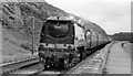
SR Bulleid Light Pacific on WR train beside the sea near Dawlish
View along the sea-front just NE of Dawlish, towards Exeter etc.: ex-GWR South Devon main line. To familiarise staff with the alternative ex-GWR and ex-LSWR routes, for many years one train a day between Exeter and Plymouth was worked by engines and crews of the other system. This was why a SR engine was working the 11.35 Exeter St Davids - Plymouth North Road. This is Bulleid Light Pacific No. 34038 'Lynton' (built 9/46 as No. 21C138, renumbered 2/49, withdrawn (unrebuilt) 6/66).
Image: © Ben Brooksbank
Taken: 4 Jul 1955
0.01 miles
2
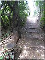
Path near Ladies Mile, Dawlish
Part of the South West Coast Path (high tide route); in the foreground is a marker reading: Great Western Railway Company Boundary 1918 Image]
Image: © David Smith
Taken: 21 Aug 2016
0.02 miles
3
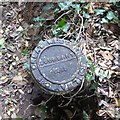
Railway property boundary marker, Dawlish
A boundary marker reading: Great Western Railway Company Boundary 1918 by the South West Coast Path (high tide route). Its context is Image]
Image: © David Smith
Taken: 21 Aug 2016
0.02 miles
4
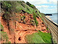
Sandstone cliffs and coastal railway near Dawlish
Image: © Roy Hughes
Taken: 19 May 2021
0.03 miles
5

Coast path following Dawlish bridleway 4
Approaching Highover House on the outskirts of Dawlish.
Image: © Derek Harper
Taken: 25 Feb 2018
0.03 miles
6
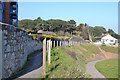
Alternative route of the South West Coast Path to the rear of Rockstone flats, Dawlish
Between Dawlish and Dawlish Warren the South West Coast Path runs along Brunel's sea wall by the railway and along the beach. In the event of rough seas battering the sea wall or the tide covering the beach, this alternative route, left, along the cliffs is recommended. The path at lower right leads to a footbridge over the railway and on to the sea wall. The rear of Rockstone flats is seen, left.
Image: © Robin Stott
Taken: 14 Mar 2016
0.03 miles
7
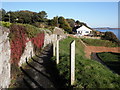
Footpath, on the cliffs above Dawlish breakwater
Image: © Roger Cornfoot
Taken: 25 Dec 2009
0.03 miles
8

Local shops, Exeter Road, Dawlish
There's a convenience store, a Chinese takeaway, a newsagent and Post Office, and Marine Court flats above.
Image: © Robin Stott
Taken: 14 Mar 2016
0.03 miles
9

Inland from the footbridge over the railway north of Dawlish
The steps lead to a footpath up to the Exeter Road, and to a bad-weather alternative route for South West Coast Path walkers (or anyone) Image Part of the back of the Rockstone flats is visible Image
Image: © Robin Stott
Taken: 14 Mar 2016
0.03 miles
10
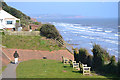
Footpath from Exeter Road to a footbridge over the railway, north end of Dawlish
The location is just east of the Rockstone flats. A southeasterly breeze is helping to make waves. In the distance, left, are the outskirts of Exmouth and the high cliffs beyond Orcombe Point.
Image: © Robin Stott
Taken: 14 Mar 2016
0.03 miles