Alternative route of the South West Coast Path to the rear of Rockstone flats, Dawlish
Introduction
The photograph on this page of Alternative route of the South West Coast Path to the rear of Rockstone flats, Dawlish by Robin Stott as part of the Geograph project.
The Geograph project started in 2005 with the aim of publishing, organising and preserving representative images for every square kilometre of Great Britain, Ireland and the Isle of Man.

There are currently over 7.5m images from over 14,400 individuals and you can help contribute to the project by visiting https://www.geograph.org.uk
Alternative route of the South West Coast Path to the rear of Rockstone flats, Dawlish
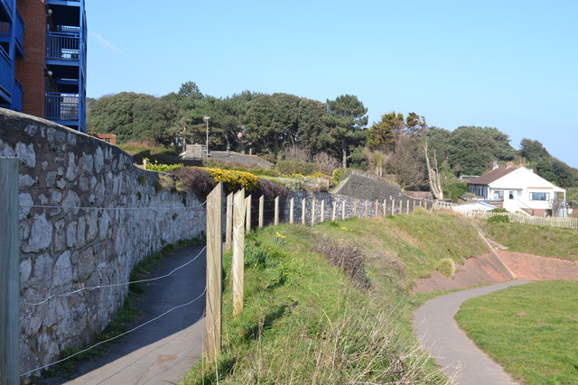
Image: © Robin Stott Taken: 14 Mar 2016
Between Dawlish and Dawlish Warren the South West Coast Path runs along Brunel's sea wall by the railway and along the beach. In the event of rough seas battering the sea wall or the tide covering the beach, this alternative route, left, along the cliffs is recommended. The path at lower right leads to a footbridge over the railway and on to the sea wall. The rear of Rockstone flats is seen, left.
Images are licensed for reuse under creativecommons.org/licenses/by-sa/2.0
Image Location
Latitude
50.587229
Longitude
-3.4555