
IMAGES TAKEN NEAR TO
Bridford, EXETER, EX6 7HY
Introduction
This page details the photographs taken nearby to EX6 7HY by members of the Geograph project.
The Geograph project started in 2005 with the aim of publishing, organising and preserving representative images for every square kilometre of Great Britain, Ireland and the Isle of Man.

There are currently over 7.5m images from over14,400 individuals and you can help contribute to the project by visiting https://www.geograph.org.uk
Image Map
Images are licensed for reuse under creativecommons.org/licenses/by-sa/2.0
Notes
- Clicking on the map will re-center to the selected point.
- The higher the marker number, the further away the image location is from the centre of the postcode.
Image Listing (59 Images Found)
Images are licensed for reuse under creativecommons.org/licenses/by-sa/2.0
Image
Details
Distance
1

Houses below Bridford village
On the road towards Christow.
Image: © Stephen Craven
Taken: 26 Aug 2016
0.15 miles
2

Delightful Devon
A view from the bridleway.
Image: © Michael Dibb
Taken: 24 Sep 2018
0.15 miles
3
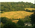
Valley side near Bridford
A view from the Bridford Inn across the Rookery Brook valley. Above the fields, which contain an alpaca herd, are woods around the disused Scatter Rock Quarry. A more detailed view of the herd is at Image
Image: © Derek Harper
Taken: 20 Jul 2013
0.17 miles
4

Alpacas near Bridford
A detail of the scene in Image], with a herd of alpacas, a popular type of livestock in this part of Devon.
Image: © Derek Harper
Taken: 20 Jul 2013
0.17 miles
5

Rood screen, Church of St Thomas a Becket, Bridford
Another view of part of the rood screen shown in Image
Image: © Derek Harper
Taken: 26 Mar 2009
0.17 miles
6

Bridford from the south
The village is on the northern slopes of the Rookery Brook valley. Seen here from Bridford Footpath 24, from the same spot as Image
Image: © Derek Harper
Taken: 5 Oct 2007
0.17 miles
7
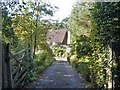
The Old Rectory
A glimpse from the lane of The Old Rectory which has 15th century or earlier origins although much altered in later centuries. Listed, grade II with details at: https://historicengland.org.uk/listing/the-list/list-entry/1318177
Image: © Michael Dibb
Taken: 24 Sep 2018
0.17 miles
8

Bridford: near the church
Village street
Image: © Martin Bodman
Taken: 1 Oct 2008
0.18 miles
9
![Down the lane [2]](https://s0.geograph.org.uk/geophotos/05/92/28/5922832_eec03103_120x120.jpg)
Down the lane [2]
The lane continues to descend towards the valley floor.
Image: © Michael Dibb
Taken: 24 Sep 2018
0.18 miles
10

Cottages, Bridford
This lane leads down into the Rookery Brook valley, becoming Bridford Bridleway 47. See Image] for a reverse view.
Image: © Derek Harper
Taken: 20 Jul 2013
0.18 miles