IMAGES TAKEN NEAR TO
Bridford, EXETER, EX6 7EH
Introduction
This page details the photographs taken nearby to EX6 7EH by members of the Geograph project.
The Geograph project started in 2005 with the aim of publishing, organising and preserving representative images for every square kilometre of Great Britain, Ireland and the Isle of Man.

There are currently over 7.5m images from over14,400 individuals and you can help contribute to the project by visiting https://www.geograph.org.uk
Image Map
Images are licensed for reuse under creativecommons.org/licenses/by-sa/2.0
Notes
- Clicking on the map will re-center to the selected point.
- The higher the marker number, the further away the image location is from the centre of the postcode.
Image Listing (9 Images Found)
Images are licensed for reuse under creativecommons.org/licenses/by-sa/2.0
Image
Details
Distance
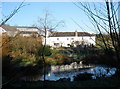
3
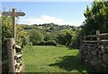
Valley at Thorn
Like Image, a view from Bridford Footpath 32 across the valley north of Heltor Rock, which is at top left. The farm at Thorn (see Image) is right if centre, partly hidden by trees.
Image: © Derek Harper
Taken: 3 Jul 2011
0.09 miles
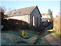
5
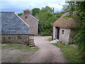
Thorn
A farm on the slopes between Heltor Rock and the deep Teign valley. The footpath to Burnicombe passes between the buildings.
Image: © Derek Harper
Taken: 25 May 2006
0.15 miles
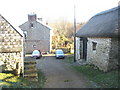
6
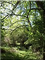
Shady path at Thorn
An attractive stretch of footpath approaching Image from the east, beneath an ash and other trees.
Image: © Derek Harper
Taken: 3 Jul 2011
0.17 miles
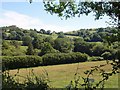
7
Towards Heltor Rock
The rock, Dartmoor's most easterly tor, is on the highest point of the skyline. The signs indicate Bridford Footpath 32. In between is the valley of a small tributary of the Teign.
Image: © Derek Harper
Taken: 3 Jul 2011
0.21 miles
8
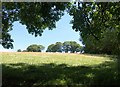
Field north of Heltor Rock
The tor can be seen from further to the eastr (left) across this field, between the trees on the far side. This view was taken roughly from the same spot as Image, also beneath an ash tree.
Image: © Derek Harper
Taken: 3 Jul 2011
0.23 miles
9
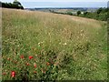
Meadow above Bridford Wood
Bridford Footpath 32 descends along the right side of this field of grass, bright with poppies in this southern corner.
Image: © Derek Harper
Taken: 3 Jul 2011
0.25 miles