IMAGES TAKEN NEAR TO
Half Moon Village, Newton St. Cyres, EXETER, EX5 5AD

Introduction

This page details the photographs taken nearby to EX5 5AD by members of the Geograph project.

The Geograph project started in 2005 with the aim of publishing, organising and preserving representative images for every square kilometre of Great Britain, Ireland and the Isle of Man.

There are currently over 7.5m images from over14,400 individuals and you can help contribute to the project by visiting https://www.geograph.org.uk

Image Map


Images are licensed for reuse under creativecommons.org/licenses/by-sa/2.0
Notes
  • Clicking on the map will re-center to the selected point.
  • The higher the marker number, the further away the image location is from the centre of the postcode.

Image Listing (15 Images Found)

Images are licensed for reuse under creativecommons.org/licenses/by-sa/2.0
Image
Details
Distance
1
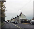
Roadside Housing, Half Moon Village
Image: © Des Blenkinsopp Taken: 27 Aug 2016
0.02 miles
2
Half Moon village on A377
Image: © John Firth Taken: 27 Oct 2015
0.04 miles
3
The main road, Half Moon Village
Image: © Roger Cornfoot Taken: 5 Aug 2010
0.05 miles
4
Weir on Creedy at Half Moon Village
During an evening downpour, this weir is seen from the north.
Image: © Derek Harper Taken: 24 Mar 2006
0.10 miles
5
East Devon : Countryside Scenery
Looking across the grassy fields towards an area near Half Moon Village.
Image: © Lewis Clarke Taken: 21 Jun 2015
0.11 miles
6
River Creedy
See Image]; this looks downstream from the same footbridge. It seems to be pouring with rain - I do have a recollection of that, and it accounts for the gloomy-looking nature of the photos; it was also well after 6 pm.
Image: © Derek Harper Taken: 24 Mar 2006
0.14 miles
7
A377 layby near Half Moon Village
Image: © J.Hannan-Briggs Taken: 20 Jul 2017
0.15 miles
8
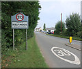
Entering Half Moon Village
Road sign at the south end of the village.
Image: © Des Blenkinsopp Taken: 27 Aug 2016
0.15 miles
9
Pond, Pens & Village
Looking towards Half Moon Village over man made pond & breeding pens.
Image: © Peter Holmes Taken: 12 Dec 2007
0.16 miles
10
River Creedy
Looking upstream, from a footbridge that carries Newton St Cyres Footpath 12, following Marsh Barton Lane, across the river. Another footpath, used by the Devonshire Heartland Way, runs along the left bank upstream here.
Image: © Derek Harper Taken: 24 Mar 2006
0.19 miles