
IMAGES TAKEN NEAR TO
Ford Rise, BIDEFORD, EX39 5GA
Introduction
This page details the photographs taken nearby to Ford Rise, EX39 5GA by members of the Geograph project.
The Geograph project started in 2005 with the aim of publishing, organising and preserving representative images for every square kilometre of Great Britain, Ireland and the Isle of Man.

There are currently over 7.5m images from over14,400 individuals and you can help contribute to the project by visiting https://www.geograph.org.uk
Image Map
Images are licensed for reuse under creativecommons.org/licenses/by-sa/2.0
Notes
- Clicking on the map will re-center to the selected point.
- The higher the marker number, the further away the image location is from the centre of the postcode.
Image Listing (43 Images Found)
Images are licensed for reuse under creativecommons.org/licenses/by-sa/2.0
Image
Details
Distance
1

Grenville Ridge housing estate, Bideford
Seen from the Tarka Trail across the River Torridge
Image: © David Smith
Taken: 23 Jan 2015
0.04 miles
2
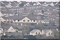
Torridge : Bideford Houses
Houses on the hillside in Bideford as seen from the Tarka Trail.
Image: © Lewis Clarke
Taken: 3 Mar 2013
0.05 miles
3

Old Ford, Bideford
A listed building (English Heritage Building ID: 375902) previously known as Ford Farm. Possibly 14th Century.
Image: © Roger A Smith
Taken: 30 Jan 2016
0.07 miles
5
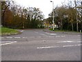
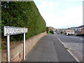
The entrance to Devonshire Park, Bideford
Image: © Roger A Smith
Taken: 19 Nov 2009
0.07 miles
6
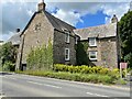
Old Ford House, Bideford
Old Ford House is a grade II* listed building alongside the A386 on the south side of Bideford. It carries a flush bracket benchmark on the far angle. See https://www.geograph.org.uk/photo/7183048 for a closer view and https://www.bench-marks.org.uk/bm11680 for details of the mark.
Image: © Brian Westlake
Taken: 20 May 2022
0.08 miles
7

Flush Bracket OSBM S2783: Bideford
Flush bracket benchmark on Old Ford House, photographed from the opposite side of the road. See https://www.geograph.org.uk/photo/7183057 for a building view and https://www.bench-marks.org.uk/bm11680 for details of the mark.
Image: © Brian Westlake
Taken: 20 May 2022
0.08 miles
9
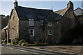
Old Ford, Bideford
A listed building (English Heritage Building ID: 375902) previously known as Ford Farm. Possibly 14th Century.
Image: © Roger A Smith
Taken: 30 Jan 2016
0.08 miles
10
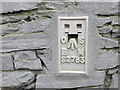
Ordnance Survey Flush Bracket S2783
This can be found on the roadside wall of The Old Ford House in Bideford.
For more detail see : http://www.bench-marks.org.uk/bm11680
Image: © Peter Wood
Taken: 3 Apr 2015
0.09 miles