
IMAGES TAKEN NEAR TO
Gorwood Road, BIDEFORD, EX39 5EZ
Introduction
This page details the photographs taken nearby to Gorwood Road, EX39 5EZ by members of the Geograph project.
The Geograph project started in 2005 with the aim of publishing, organising and preserving representative images for every square kilometre of Great Britain, Ireland and the Isle of Man.

There are currently over 7.5m images from over14,400 individuals and you can help contribute to the project by visiting https://www.geograph.org.uk
Image Map
Images are licensed for reuse under creativecommons.org/licenses/by-sa/2.0
Notes
- Clicking on the map will re-center to the selected point.
- The higher the marker number, the further away the image location is from the centre of the postcode.
Image Listing (17 Images Found)
Images are licensed for reuse under creativecommons.org/licenses/by-sa/2.0
Image
Details
Distance
1

The village street, Buckland Brewer
The lane from Gorwood comes in on the left. The tall church tower stands proud, yet is hidden by trees when standing in front of the lychgate.
Image: © Humphrey Bolton
Taken: 8 Apr 2010
0.00 miles
2

Datestone on the Methodist Chapel, Buckland Brewer
The William Reed Memorial Chapel, 1903. Why the stones inscribed 'Congregation' and 'Sunday Schools'? Nowadays the Methodists and other non-conformists like to call their buildings 'churches' although this is not strictly correct.
Image: © Humphrey Bolton
Taken: 8 Apr 2010
0.07 miles
3
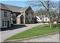
Shop and chapel, Buckland Brewer
I think I remember the shop being a butcher's. The chapel is 'Buckland Brewer Methodist Church' (see Image for datestone) and the small village green is on the right.
Image: © Humphrey Bolton
Taken: 8 Apr 2010
0.07 miles
4

War memorial and lychgate, Buckland Brewer
The lychgate is not in line with the path up to the church porch. Despite being so tall, the church tower is obscured by trees from this viewpoint.
Image: © Humphrey Bolton
Taken: 8 Apr 2010
0.07 miles
5
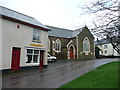
Butchers shop and Methodist church
Two key elements in village life in Buckland Brewer.
Image: © Jonathan Billinger
Taken: 16 Jan 2008
0.09 miles
6

The Coach and Horses Inn, Buckland Brewer
A thatched pub dating back to the 13th century, on the eastern edge of the village.
Image: © Jonathan Billinger
Taken: 16 Jan 2008
0.11 miles
7
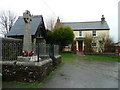
War memorial, lychgate and cottage
By St. Mary and St. Benedict's church, Buckland Brewer.
Image: © Jonathan Billinger
Taken: 16 Jan 2008
0.11 miles
8
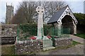
Buckland Brewer war memorial
Buckland Brewer war memorial is situated next to the lychgate entrance to the parish church.
Image: © Philip Halling
Taken: 10 Apr 2015
0.12 miles

10
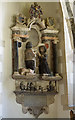
St Mary & St Benedict's church, Buckland Brewer - monument to Anthony Dennis & wife
The kneeling effigies of Anthony Dennis (†1656), his wife, and children.
Image: © Mike Searle
Taken: 3 Jun 2013
0.14 miles