
IMAGES TAKEN NEAR TO
Stibb Cross, TORRINGTON, EX38 8JQ
Introduction
This page details the photographs taken nearby to EX38 8JQ by members of the Geograph project.
The Geograph project started in 2005 with the aim of publishing, organising and preserving representative images for every square kilometre of Great Britain, Ireland and the Isle of Man.

There are currently over 7.5m images from over14,400 individuals and you can help contribute to the project by visiting https://www.geograph.org.uk
Image Map
Images are licensed for reuse under creativecommons.org/licenses/by-sa/2.0
Notes
- Clicking on the map will re-center to the selected point.
- The higher the marker number, the further away the image location is from the centre of the postcode.
Image Listing (24 Images Found)
Images are licensed for reuse under creativecommons.org/licenses/by-sa/2.0
Image
Details
Distance
1
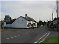
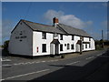
Old Union Inn
Pub at junction of A388 and B3227 in Stibb Cross
Image: © Geoff Gartside
Taken: 30 Sep 2007
0.01 miles
3
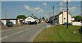
Stibb Cross
The village is at the junction of the A388, in the foreground and which turns left on this side of the Union Inn and the B3227, which has priority, although it is far less busy. The right turn is for Shebbear.
Image: © Derek Harper
Taken: 23 May 2018
0.04 miles
4
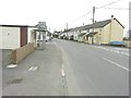
Crossroads at Stibb Cross
Great Torrington is straight on along the B3227. Bideford is left along the A388 while the road to the right would take you to Battledown Cross in square Image
Image: © John Baker
Taken: 25 Mar 2013
0.05 miles

6

Bus shelter and notices at the heart of Stibb Cross
The village is served by a few buses each day
Image: © David Smith
Taken: 21 Mar 2019
0.07 miles
7
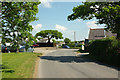
Stibb Cross
The road from Thorne Moor arrives at the junction with the A388 at the west end of the village. On the right is the former Methodist chapel shown in http://www.geograph.org.uk/search.php?i=84503986 . The car park on the left seems to be occupied by cars for sale.
Image: © Derek Harper
Taken: 23 May 2018
0.09 miles
8

B3227 at Stibb Cross
The road to Langtree heads east through the village.
Image: © Derek Harper
Taken: 23 May 2018
0.10 miles
9
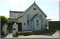
Former chapel, Stibb Cross
A similar view to Image The converted Methodist chapel dates "from the late 1890's, presenting stone rendered elevations beneath a slate roof with ornate facias and Gothic style arched windows. The property was converted in 1998" https://www.onthemarket.com/details/3699173/ . See also http://www.geograph.org.uk/search.php?i=84503986 .
Image: © Derek Harper
Taken: 23 May 2018
0.11 miles
10
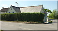
Former chapel, Stibb Cross
A rather restricted view of the converted Methodist chapel shown in Image], across the A388 by its junction (right) with the road to Thorne Cross; see also http://www.geograph.org.uk/search.php?i=84503986 . Behind the chapel on the left is The Manse.
Image: © Derek Harper
Taken: 23 May 2018
0.11 miles