
IMAGES TAKEN NEAR TO
Furzebeam Row, TORRINGTON, EX38 8DH
Introduction
This page details the photographs taken nearby to Furzebeam Row, EX38 8DH by members of the Geograph project.
The Geograph project started in 2005 with the aim of publishing, organising and preserving representative images for every square kilometre of Great Britain, Ireland and the Isle of Man.

There are currently over 7.5m images from over14,400 individuals and you can help contribute to the project by visiting https://www.geograph.org.uk
Image Map
Images are licensed for reuse under creativecommons.org/licenses/by-sa/2.0
Notes
- Clicking on the map will re-center to the selected point.
- The higher the marker number, the further away the image location is from the centre of the postcode.
Image Listing (28 Images Found)
Images are licensed for reuse under creativecommons.org/licenses/by-sa/2.0
Image
Details
Distance
1

Ordnance Survey Cut Mark
This OS cut mark can be found on the gatepost of No5 Furzebeam Row. It marks a point 94.528m above mean sea level.
Image: © Adrian Dust
Taken: 5 Dec 2019
0.02 miles
2
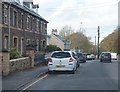
Old houses on New Street
Exiting Great Torrington towards Bideford on the A386.
Image: © Fernweh
Taken: 28 Oct 2015
0.02 miles
3
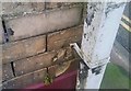
Ordnance Survey Cut Mark
This OS cut mark can be found on No213 New Street. It marks a point 101.773m above mean sea level.
Image: © Adrian Dust
Taken: 5 Dec 2019
0.12 miles
4
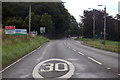
A386 entering Great Torrington
B3227 Junction to Taddiport on the right.
Image: © J.Hannan-Briggs
Taken: 20 Jul 2017
0.13 miles
5

Railed Fundamental Bench Mark and Play Area on Great Torrington Common
Looking north-eastward.
For more information on the Fundamental Bench Mark see : https://www.bench-marks.org.uk/bm1164
Image: © Peter Wood
Taken: 2 Apr 2015
0.14 miles
6
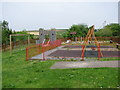
Children's playground on the edge of Torrington
Image: © Sarah Charlesworth
Taken: 26 May 2010
0.14 miles
7

Toilet block by car park on Torrington Common
Image: © David Smith
Taken: 26 Dec 2011
0.14 miles
8
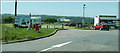
Torrington Picnic and parking area
Situated on the outskirts of the town, this is a popular stopping area. The snack bar is always at this spot. This is the site for a bi-annual bonfire spectacular, organised by a group called the Torrington cavaliers. They build a large scale wooden replica of a famous building or similar and this is then the centre for a summer fireworks spectacular, organised to raise money for charity. The sign on the left is advertising this year's event, for which they have built a replica of HMS Victory. (see other picture)
Image: © Mike Crowe
Taken: 10 Jun 2005
0.15 miles

10
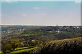
Torrington from the west
The church spire of St Michael and All Angels' is to the right of centre. Below this is the A386, Station Hill. To the left is Dartington Crystal. The golf ball shaped National Air Traffic Services radar at Eaglescott airfield is just visible towards the right side of the image above the roof tops.
Image: © Roger A Smith
Taken: 7 Apr 2017
0.17 miles