IMAGES TAKEN NEAR TO
Apsley Terrace, BRAUNTON, EX33 2EG
Introduction
This page details the photographs taken nearby to Apsley Terrace, EX33 2EG by members of the Geograph project.
The Geograph project started in 2005 with the aim of publishing, organising and preserving representative images for every square kilometre of Great Britain, Ireland and the Isle of Man.

There are currently over 7.5m images from over14,400 individuals and you can help contribute to the project by visiting https://www.geograph.org.uk
Image Map
Images are licensed for reuse under creativecommons.org/licenses/by-sa/2.0
Notes
- Clicking on the map will re-center to the selected point.
- The higher the marker number, the further away the image location is from the centre of the postcode.
Image Listing (26 Images Found)
Images are licensed for reuse under creativecommons.org/licenses/by-sa/2.0
Image
Details
Distance
1
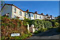
Braunton : Apsley Terrace
Looking along Apsley Terrace off Ash Road.
Image: © Lewis Clarke
Taken: 21 Sep 2021
0.01 miles
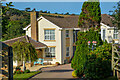
2
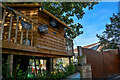
Braunton : Sans Souci
A treehouse on the property.
Image: © Lewis Clarke
Taken: 21 Sep 2021
0.04 miles
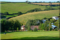
4

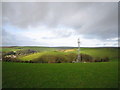
A view across east Braunton towards the Artavia TV mast
See also:Image
To the left, just below centre, are houses on Downs Lane. In the lower left corner are houses in Rectory Close and surrounding streets. Following Downs lane diagonally upwards and across the image leads to Green Lane, just before centre image. The TV mast is on the horizon. The houses below this are those on and around Higher and Lower Park Road. A water tower on Chivenor airfield is in the lower right corner.
Image: © Roger A Smith
Taken: 10 Mar 2016
0.05 miles
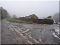
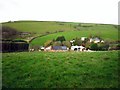
6
Braunton : Blackwells Lodge
Looking down the hillside garden of the house.
Image: © Lewis Clarke
Taken: 21 Sep 2021
0.08 miles
7
Braunton : Conifers
Conifers on Ash Road.
Image: © Lewis Clarke
Taken: 21 Sep 2021
0.09 miles
9
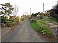
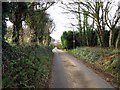
Ash Road
Ash Road, the track on the right of the photo is Ash Lane.
Image: © Chris McAuley
Taken: 24 Dec 2011
0.11 miles
10
Valley view
A valley view from Ash Road.
Image: © Chris McAuley
Taken: 24 Dec 2011
0.13 miles