
IMAGES TAKEN NEAR TO
Stove Road, BARNSTAPLE, EX31 1AN
Introduction
This page details the photographs taken nearby to Stove Road, EX31 1AN by members of the Geograph project.
The Geograph project started in 2005 with the aim of publishing, organising and preserving representative images for every square kilometre of Great Britain, Ireland and the Isle of Man.

There are currently over 7.5m images from over14,400 individuals and you can help contribute to the project by visiting https://www.geograph.org.uk
Image Map
Images are licensed for reuse under creativecommons.org/licenses/by-sa/2.0
Notes
- Clicking on the map will re-center to the selected point.
- The higher the marker number, the further away the image location is from the centre of the postcode.
Image Listing (55 Images Found)
Images are licensed for reuse under creativecommons.org/licenses/by-sa/2.0
Image
Details
Distance
1
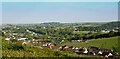
Looking across the north eastern suburbs of Barnstaple and some of Pilton
The house on the horizon to the left of centre is Upcott House. Pilton Church is in the far left whilst the North Devon District hospital is to the far right. The houses in the foreground are on Silverwood Heights.
Image: © Roger A Smith
Taken: 17 May 2023
0.08 miles
2

Shearford Lane at its junction with Westaway Plain
Image: © Roger A Smith
Taken: 7 Jan 2011
0.08 miles

4
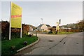
Shearford Close, a recent housing development on the outskirts of Barnstaple
Image: © Roger A Smith
Taken: 13 Mar 2017
0.09 miles
5
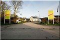
Shearford Close, a recent housing development on the outskirts of Barnstaple
Image: © Roger A Smith
Taken: 13 Mar 2017
0.09 miles
7
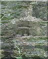
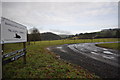
Ordnance Survey Cut Mark
This OS cut mark can be found on the NW side of Mear Top. It marks a point 45.741m above mean sea level.
Image: © Adrian Dust
Taken: 8 Jul 2016
0.10 miles
8
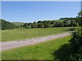
Drive to Westaway
A glimpse of the facade and the two-storey porch of the C18 house can be seen through the trees http://www.imagesofengland.org.uk/Details/Default.aspx?id=98245&mode=adv , seen from Westaway Plain. On the left is the valley of Bradiford Water.
Image: © Derek Harper
Taken: 1 Jun 2009
0.10 miles
10
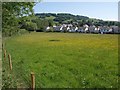
Housing on Youing's Drive, Barnstaple
From a footpath beside Maer Top, looking across a meadow to a new estate northeast of the town. The hill behind carries Burridge Fort, in Image
Image: © Derek Harper
Taken: 1 Jun 2009
0.13 miles