IMAGES TAKEN NEAR TO
Turnstone Road, EXETER, EX2 6FH
Introduction
This page details the photographs taken nearby to Turnstone Road, EX2 6FH by members of the Geograph project.
The Geograph project started in 2005 with the aim of publishing, organising and preserving representative images for every square kilometre of Great Britain, Ireland and the Isle of Man.

There are currently over 7.5m images from over14,400 individuals and you can help contribute to the project by visiting https://www.geograph.org.uk
Image Map
Images are licensed for reuse under creativecommons.org/licenses/by-sa/2.0
Notes
- Clicking on the map will re-center to the selected point.
- The higher the marker number, the further away the image location is from the centre of the postcode.
Image Listing (132 Images Found)
Images are licensed for reuse under creativecommons.org/licenses/by-sa/2.0
Image
Details
Distance
1
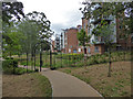
New development, Millbrook Lane, Exeter
Seen from a path running alongside the boundary of the crematorium site and leading down to the former leat to the paper mill at Countess Wear. According to the map there is a public right of way along this row of buildings but it seems to be barred by this gate with a combination lock. A look at the Devon government website implies that the foot path no longer passes this way but passes to the left and along the leat. To be fair, it's a nicer walk but I do find it irritating that it was allowed to be apparently diverted.
Image: © Chris Allen
Taken: 4 Aug 2020
0.03 miles
2
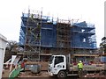
Constructing an apartment block, Exeter
Image: © David Smith
Taken: 10 Jan 2017
0.05 miles
3

Orange Way in Devon and Torbay (259)
The walk passes an apparently disused parking area.
Image: © Shazz
Taken: 19 Nov 2011
0.05 miles
4

Footpath near Millbrook House
The diverted path mentioned at Image], cutting away down to the mill race from the line shown there.
Image: © Derek Harper
Taken: 4 Feb 2013
0.05 miles
5
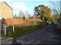
Orange Way in Devon and Torbay (257)
This is a relatively insalubrious part of the walk.
Image: © Shazz
Taken: 17 Nov 2011
0.05 miles
6
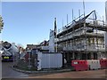
Building site for new housing estate
The same location as Image, where the former St Loyes College has been demolished and a large estate has been planned
Image: © David Smith
Taken: 15 Jan 2015
0.05 miles
7

Temporary footpath on new housing estate, Exeter
Pedestrians were diverted to this path while the grounds of the estate were being landscaped. Actually, few pedestrians apart from construction workers use the muddy track
Image: © David Smith
Taken: 10 Jan 2017
0.06 miles
8
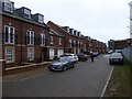
Houses in Brooklands, Exeter
A 21st century housing estate; road names refer to the nearby leat and stream
Image: © David Smith
Taken: 10 Jan 2017
0.06 miles
9

Site of St Loye's College
From Exeter Footpath 49, which turns left here around the site. On the right is a pile of demolition debris. http://www.exeter.gov.uk/CHttpHandler.ashx?id=6389&p=0 specifies a number of buildings and other features that should be retained on the site; I wonder how many have survived? (the distinctive listed Lodge on the Topsham Road certainly has).
Image: © Derek Harper
Taken: 4 Feb 2013
0.06 miles