
IMAGES TAKEN NEAR TO
Ceres Court, BUDE, EX23 8TD
Introduction
This page details the photographs taken nearby to Ceres Court, EX23 8TD by members of the Geograph project.
The Geograph project started in 2005 with the aim of publishing, organising and preserving representative images for every square kilometre of Great Britain, Ireland and the Isle of Man.

There are currently over 7.5m images from over14,400 individuals and you can help contribute to the project by visiting https://www.geograph.org.uk
Image Map
Images are licensed for reuse under creativecommons.org/licenses/by-sa/2.0
Notes
- Clicking on the map will re-center to the selected point.
- The higher the marker number, the further away the image location is from the centre of the postcode.
Image Listing (48 Images Found)
Images are licensed for reuse under creativecommons.org/licenses/by-sa/2.0
Image
Details
Distance
1
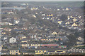
Bude : Bude Scenery
Looking down into the town of Bude.
Image: © Lewis Clarke
Taken: 23 Feb 2020
0.05 miles
2
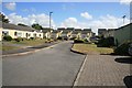
Bude Station site
This would have been the view inland towards Okehampton and Waterloo !
Image: © roger geach
Taken: 5 Jul 2010
0.06 miles
3
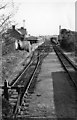
Bude Station
View southward, towards Halwill; ex-London & South Western terminus of line from Halwill, Okehampton, Exeter etc. Station and line from Halwill closed 3/10/66.
Image: © Ben Brooksbank
Taken: 17 Apr 1964
0.06 miles
4
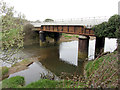
Former railway bridge over the River Neet in Bude
The bridge carried the Bude Wharf siding to the harbour.
Image: © Gareth James
Taken: 19 Mar 2017
0.08 miles
5

Bude station site plaque
The clock and plaque mark the spot where Bude railway station once stood. The modern residential estate must have been built in the 1984-85 period on the site of the old railway. I bet most younger residents of Bude do not know there was ever a station here.
Image: © roger geach
Taken: 5 Jul 2010
0.08 miles
6
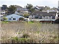
Cycle bridge over river at Bude
Part of NCN3 along the former railway line
Image: © David Smith
Taken: 15 Apr 2016
0.09 miles
7
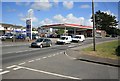
Petrol Station at Bude
The view from Bulleid Way looking across at the Petrol station. Bulleid Way may give a clue that this road once led to what was the railway station at Bude.
Image: © roger geach
Taken: 5 Jul 2010
0.10 miles
8

Bude Bulleid way once the railway station
You would never know it but this is where Budes railway station once stood.
There is a clock and inscription on the wall of the nearest house.
The station's closure in 1966 left residents of Bude and the surrounding area with Okehampton station, some 30 miles away, as their nearest connection to the railway. This increased to 69 miles in 1972 when Okehampton itself closed, leaving Exeter as the nearest railhead.
Image: © roger geach
Taken: 5 Jul 2010
0.10 miles
9

N Class 2-6-0 31874 at Bude, 1963
Running round its train. Although built for the South Eastern and Chatham Railway, this class of engine was very versatile and found its way to all parts of the former Southern Railway territory.
Image: © Alan Murray-Rust
Taken: Unknown
0.10 miles
10
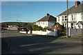
Valley Road, Bude
Suburban semis on a road that reaches a junction with Bencoolen Road, the (unclassified) main road into the centre of Bude.
Image: © Derek Harper
Taken: 19 Jan 2017
0.10 miles