Bude Bulleid way once the railway station
Introduction
The photograph on this page of Bude Bulleid way once the railway station by roger geach as part of the Geograph project.
The Geograph project started in 2005 with the aim of publishing, organising and preserving representative images for every square kilometre of Great Britain, Ireland and the Isle of Man.

There are currently over 7.5m images from over 14,400 individuals and you can help contribute to the project by visiting https://www.geograph.org.uk
Bude Bulleid way once the railway station
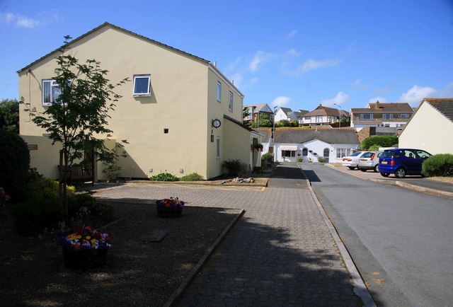
Image: © roger geach Taken: 5 Jul 2010
You would never know it but this is where Budes railway station once stood. There is a clock and inscription on the wall of the nearest house. The station's closure in 1966 left residents of Bude and the surrounding area with Okehampton station, some 30 miles away, as their nearest connection to the railway. This increased to 69 miles in 1972 when Okehampton itself closed, leaving Exeter as the nearest railhead.
Images are licensed for reuse under creativecommons.org/licenses/by-sa/2.0
Image Location
Latitude
50.825281
Longitude
-4.541755