
IMAGES TAKEN NEAR TO
Crackington Haven, BUDE, EX23 0JZ
Introduction
This page details the photographs taken nearby to EX23 0JZ by members of the Geograph project.
The Geograph project started in 2005 with the aim of publishing, organising and preserving representative images for every square kilometre of Great Britain, Ireland and the Isle of Man.

There are currently over 7.5m images from over14,400 individuals and you can help contribute to the project by visiting https://www.geograph.org.uk
Image Map
Images are licensed for reuse under creativecommons.org/licenses/by-sa/2.0
Notes
- Clicking on the map will re-center to the selected point.
- The higher the marker number, the further away the image location is from the centre of the postcode.
Image Listing (59 Images Found)
Images are licensed for reuse under creativecommons.org/licenses/by-sa/2.0
Image
Details
Distance
1
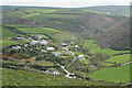
St Gennys: Ludon
Houses at Ludon stand above Crackington Haven, on the road to Middle, Lower and Higher Crackington. Hard right, above the first green field, a lane leads along the coast, inland from High Cliff, to the farmhouse owned by the National Trust at Trevigue. Above the lane is the Ludon valley. Seen from the path between St Gennys churchtown and Pencarrow Point
Image: © Martin Bodman
Taken: 22 Apr 2009
0.02 miles
2
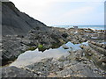
Rock pool at Crackington Haven Cornwall
On the southern side of the haven looking west
Image: © Clive Perrin
Taken: 11 Sep 2005
0.08 miles
3
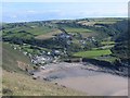
Crackington Haven
Taken from the cliff around SX140972, but covering a good proportion of the SX1496 grid square with Crackington Haven nestling at the bottom of the valley. This was taken in 2003, before the 2004 floods which washed away the car park and footbridge.
Image: © Paul Dixon
Taken: Unknown
0.08 miles
5
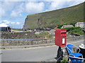
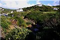
Crackington Haven: postbox № EX23 69
A small postbox with its back to fine views across the bay. It is emptied finally at 3pm on weekdays and at 10:30am on Saturdays.
Image: © Chris Downer
Taken: 25 Aug 2009
0.15 miles
6
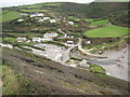
Crackington Haven
Crackington Haven viewed from the South West Coast Path as it descends into the village.
Image: © Philip Halling
Taken: 28 Sep 2009
0.15 miles
7
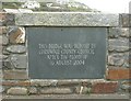
Plaque on a bridge, Crackington Haven, St Gennys
Inscribed in a calligraphic style on slate.
Image: © Humphrey Bolton
Taken: 7 May 2009
0.15 miles
8
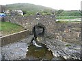
Footbridge, Crackington Haven, St Gennys
Unfortunately I can't remember whether it is this footbridge or the road bridge on which I was standing that has the plaque shown in Image
Image: © Humphrey Bolton
Taken: 7 May 2009
0.15 miles
9
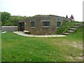
Surf Life-saving Club, Crackington Haven, St Gennys
A clubhouse built into an embankment and invisible from a distance.
Image: © Humphrey Bolton
Taken: 7 May 2009
0.15 miles
10
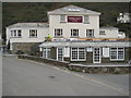
Coombe Barton Inn
The Coombe Barton Inn in Crackington Haven.
Image: © Philip Halling
Taken: 28 Sep 2009
0.15 miles